Kong-Rey

GPM's GMI Measures Weakening Kong-Rey's Rainfall

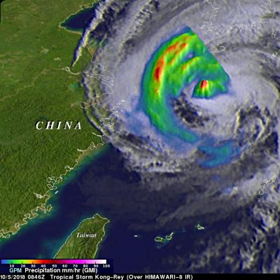
The GPM core observatory passed above tropical storm Kong-Rey on October 5, 2018 at 0846 UTC. Kong-Rey was a powerful category five typhoon just a few days ago but increased vertical wind shear and cooler sea surface temperatures have caused the tropical cyclone to weaken dramatically. Tropical storm Kong-Rey had maximum sustained winds of about 55 kts (63 mph) when it was scanned by the satellite. GPM's Microwave Imager (GMI) data were used to gauge the intensity of precipitation around Kong-Rey's center of circulation. Energy observed through clouds by GMI's microwave channels was used to

TRMM Sees Heavy Rain Over Taiwan

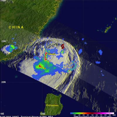
The TRMM satellite flew directly above western Taiwan on August 28, 2013 at 2108 UTC when tropical storm Kong-Rey was dropping enormous amounts of rain. Flooding from torrential rainfall with totals of over 500mm (~19.7 inches) have been reported in western Taiwan. This rainfall analysis from TRMM's Microwave Imager (TMI) and Precipitation Radar (PR) instruments revealed that precipitation was falling at a rate of over 205mm/hr (~8 inches) in intense bands of rain over southwestern Taiwan. Tropical storm Kong-Rey's location when TRMM flew over is shown with a red symbol. This TRMM orbit also

Tropical Storm Kong-Rey To Hit Taiwan Then Japan

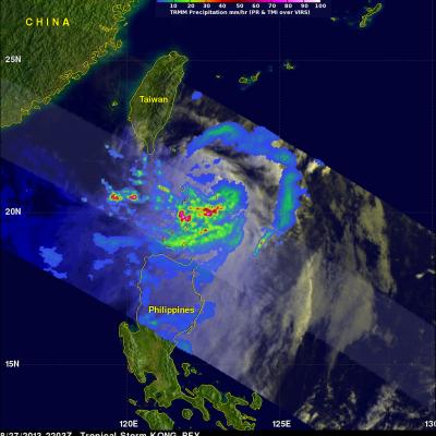
Tropical storm Kong-Rey formed in the western Pacific Ocean east of the Philippines on August 26, 2013. Kong-rey passed to the northeast of the Philippines and is predicted to cross over northeastern Taiwan tomorrow. In about three days it is then predicted to be the first tropical cyclone of 2013 to hit southern Japan. The TRMM satellite had an early morning view of tropical storm Kong-Rey on August 27, 2013 at 2203 UTC (~6:03 AM local time). A precipitation analysis from TRMM's Microwave Imager (TMI) and Precipitation Radar (PR) instruments is shown on the left above overlaid on an enhanced