Mexico

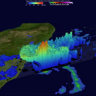
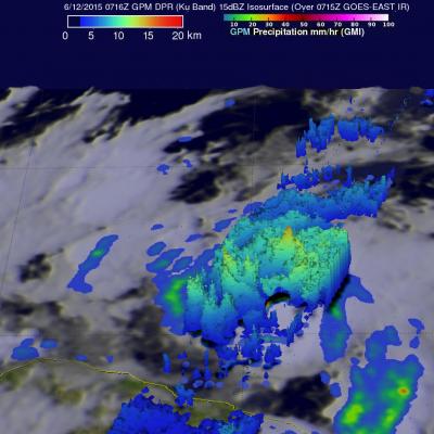
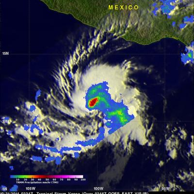
NASA IMERG Data Measures Hurricane Sandra's Rainfall

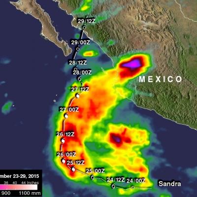
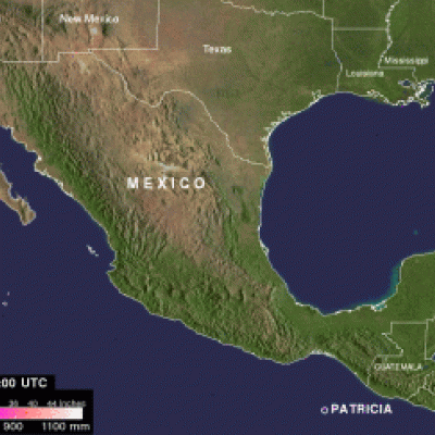
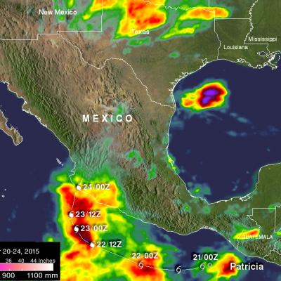
Data from NASA's Integrated Multi-satellitE Retrievals for GPM (IMERG) were used to estimate the amount of rainfall that hurricane Sandra produced during the period from November 23-29, 2015. Sandra remained well off the Mexican coast during the most dangerous period from November 25-27, 2015 when Sandra was a powerful hurricane with sustained winds of up to 130 kts (150 mph). This analysis shows that much of Sandra's rainfall occurred over the open waters of the Eastern Pacific. This analysis indicates that moisture flowing from hurricane Sandra also caused heavy rainfall totals of over 700

Patricia Remnants Combine With Storm System Over Texas

Patricia, the most powerful hurricane on record in the Western Hemisphere, quickly lost power as it moved over Mexico. Then an upper-level low pressure system and the remnants of hurricane Patricia combined to cause very heavy rain in Texas. On Sunday October 25, 2015 eastern Texas, Louisiana and Mississippi were also warned of flooding as extreme rainfall moved eastward along the Gulf Coast.
Hurricane Patricia Makes Landfall in Mexico
The eye of hurricane Patricia hit the Mexican coast on October 23, 2015 at approximately 6:15 PM CDT(2315 UTC)near Cuixmala, Mexico. The maximum winds at that time were estimated to be 143 kts (165 mph). Patricia is weakening rapidly but continued heavy rain is expected to cause flash floods and mudslides in the Mexican states of Nayarit, Jalisco, Colima, Michoacan and Guerrero through Saturday October 24, 2015. Over the weekend the remants of Patricia are also expected to add to the extreme rainfall in Texas. Rainfall from a stalled front that has been causing flooding in northern and central...

GPM Sees Patricia Becoming A Hurricane

During the night tropical storm Patricia became much better organized and was upgraded to a hurricane. The GPM core observatory satellite flew above the intensifying tropical cyclone on October 22, 2015 at 0401 UTC. Patricia was still a tropical storm with maximum sustained winds estimated at 55 kts (63 mph) at that time but rainfall derived from GPM's Microwave Imager (GMI) and Dual-Frequency Precipitation Radar (DPR) instruments showed that an eye was forming. The National Hurricane Center (NHC) 0400 AM CTD discussion said that, "... 37 GHz GPM image showed a cyan ring around the eye, which

Tropical Storm Patricia Forms Off Mexican Coast

Tropical Depression Twenty-E (TD20E) formed on October 20, 2015 off the Mexican coast southeast of Puerto Escondido, Mexico. Later that evening TD20E was upgraded to tropical storm Patricia. On October 21, 2015 at 1634 UTC (11:34 AM CDT) the GPM core observatory satellite flew over tropical storm Patricia. GPM's Microwave Imager (GMI) instrument had good coverage of the rainfall associated with the tropical storm. Rainfall data derived from GMI are shown overlaid on a GOES-EAST Visible/Infrared image captured at 1645 UTC (11:45 AM CDT). GPM's Dual-Frequency Precipitation Radar (DPR) instrument

Tropical Storm Marty Tries to Strengthen South of Mexico

Tropical Storm Marty, which formed into an depression from an area of low pressure about 300 miles southwest of Acapulco, Mexico Saturday afternoon (local time), has been trying to strengthen while drifting slowly northward toward the southwest coast of Mexico. This first image was captured by NASA's GPM core satellite at 00:11 UTC 27 September (7:11 pm CDT 26 September) just a few hours after Marty had formed into a tropical depression. GPM shows substantial areas of rain on the eastern half of the storm, but more importantly, there is already evidence of curvature and banding within those

Tropical Storm Carlos Viewed By GPM

Tropical storm Carlos is the third tropical cyclone in what promises to be a busy 2015 eastern Pacific hurricane season. The GPM core observatory satellite flew directly above Carlos on June 12, 2015 at 0716 UTC. GPM's Microwave Imager (GMI) and Dual-Frequency Precipitation Radar (DPR) instruments showed that heavy rain was falling in a band of powerful storms to the southeast of the tropical storm's center of circulation. Rainfall was measured by GPM radar (Ku band) falling at a rate of almost 70 mm (2.8 inches) per hour in Carlos' most intense areas of rainfall. Those same radar data were

Hurricane Vance Weakening, Heading Toward Mexico

The TRMM satellite flew over hurricane Vance on November 2014 at 0953 UTC. Rainfall derived from TRMM's Microwave Imager (TMI) data collected with that view are shown overlaid on a 1000 UTC GOES-WEST image. This analysis showed that Vance had a large area of heavy rainfall near the center of the hurricane. Some intense storms in that area were dropping rain at a rate of over 50mm/hr (almost 2 inches) per hour. Vance's power peaked late on November 3, 2014 with winds of about 95 kts (about 109 mph). Vertical wind shear had started to weaken the hurricane at the time of this view but Vance was

Tropical Storm Vance Forms

The hurricane season continues to be active in the eastern Pacific Ocean. A Tropical depression south of southern Mexico was upgraded to tropical storm Vance yesterday. The National Hurricane Center (NHC) predicts that Vance will become a hurricane Sunday morning making it the sixteenth hurricane of the 2014 eastern Pacific Ocean hurricane season. TRMM's Microwave imager (TMI) had a good view of the rainfall around tropical storm Vance on October 31, 2014 at 0234 UTC. An analysis of this rainfall is shown overlaid on a 0245 UTC GOES-EAST enhanced infrared image. Intense convective

Tropical Depression 18E Forms

Tropical cyclones have continued to form in the eastern Pacific Ocean at a faster rate than last year. This morning at 8 AM PDT (1500 UTC) a low pressure center south of Mexico was upgraded to a tropical depression (18E). The TRMM satellite crossed over the forming tropical depression on September 23, 2014 at 0729 UTC (00:20 AM PDT). TRMM's Precipitation Radar (PR) instrument found that rain was falling at a rate of almost 61 mm (2.4 inches) per hour near the low's center of circulation. Radar reflectivity values of over 51 dBZ were analyzed in some heavy showers by TRMM PR. This simulated 3-D