Mozambique

IMERG rainfall totals from Cyclone Freddy
Tropical Cyclone Freddy first made landfall along the east coast of Madagascar just north of the town of Mananjary on Feb. 21, 2023, as a Category 3 cyclone with average winds reported at ~81 mph (130 km/h) and gusts up to ~112 mph (180 km/h). After crossing over Madagascar Freddy continued westward over the Mozambique Channel before making landfall again along the east coast of Mozambique just south of Vilankulos as a moderate tropical storm with sustained winds estimated at 50 mph. Despite being weaker at landfall, Freddy caused widespread flooding across parts of Mozambique due to the storm stalling out near the coast after making landfall. Incredibly, Freddy drifted back out over the Mozambique Channel, nearly making landfall along the southwest coast of Madagascar. It then changed direction, re-intensified, weakened, re-intensified one last time, and made landfall once again on March 11 near Quelimane, Mozambique, as a Category 1 cyclone with sustained winds reported at 90 mph.

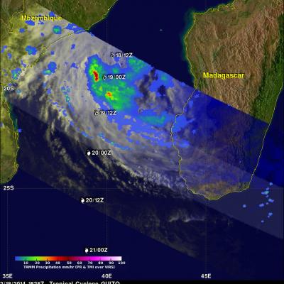
GPM Examines Deadly Tropical Cyclone Dineo

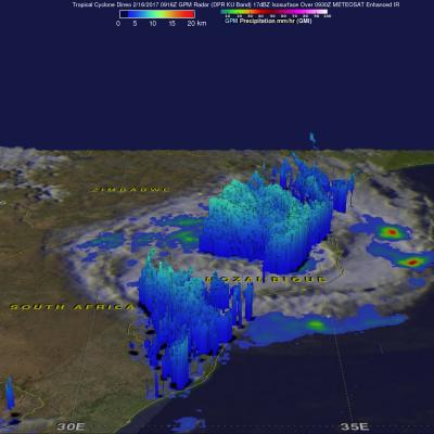
Dineo has now weakened to a tropical depression but the tropical cyclone had winds of over 70 kts (80.5 mph) when it hit Mozambique. Four people have been reported killed by Dineo. The GPM core observatory satellite flew over Mozambique on February 16, 2016 at 0916 UTC after Dineo's maximum sustained winds had fallen to about 60 kts (69 mph). Data collected by GPM's Microwave Imager (GMI) and Dual-Frequency Precipitation Radar (DPR) instruments showed that the tropical cyclone was still dropping light to moderate rainfall over a large area of southern Mozambique. This GPM view revealed that

Tropical Cyclone Guito's Rainfall

The TRMM satellite had a look at tropical cyclone Guito in the Mozambique Channel on February 18, 2014 at 1525 UTC. This early evening view occurred only about three hours after Guito attained tropical storm intensity of 35kts (~40 mph). TRMM's Microwave Imager (TMI) had better coverage of Guito than the Precipitation Radar (PR) instrument whose swath was well to the south of the tropical cyclone's center of circulation. TRMM TMI revealed that Guito was producing rain at a rate of over 50mm/hr (~ 2 inches) in the center of the Mozambique Channel and scattered light rain on Madagascar's western

TRMM sees Powerful Tropical Cyclone Funso

The TRMM satellite had a good view of powerful tropical cyclone Funso battering the Mozambique coast when it flew over on 23 January 2012 at 1451 UTC. TRMM data shows that Funso was dropping moderate to heavy rainfall in bands covering the Mozambique channel from eastern Mozambique to western Madagascar. Storms and floods from Funso have killed at least 22 people and forced tens of thousands from their homes in Mozambique. Tropical cyclone Funso formed in the Mozambique channel off the coast of Mozambique on 19 January 2012. The image above shows what TRMM saw on 21 January 2012 when Funso had