South Pacific

GPM Flies Over Category 4 Cyclone Harold in the South Pacific

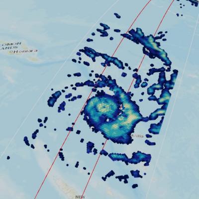
For more information or to download this public domain video, go to: https://svs.gsfc.nasa.gov/4812#29226 UPDATE 4/9/2020 This animation shows the heavy precipitation associated with Tropical Cyclone Harold as it progressed from the Solomon Islands (upper left) on April 2, 2020, explosively intensified on April 3, reached Vanuatu (center) as a Category 4 storm on April 5 before briefly attaining Category 5 status on April 6 and passing just south of Fiji (center right) on April 7 as a Category 4 storm. Periodically, Harold's core region produced precipitation rates in excess of 30 millimeters

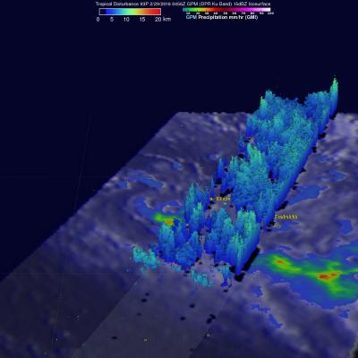
GPM See Potential Tropical Cyclone

The GPM core observatory satellite flew over an area of disturbed weather in the South Pacific near Bora Bora early today where a tropical cyclone may be forming. On February 29, 2016 at 0456 UTC GPM's Microwave Imager (GMI) saw rain falling at an estimated rate of almost 48 mm (1.9 inches) per hour in an area of deep convection south of a tropical low. GPM's Dual-frequency Precipitation Radar (DPR) instrument measured cloud top heights at an altitude of over 10.5 km (6.5 miles) in rain showers between Bora Bora and Tahiti.

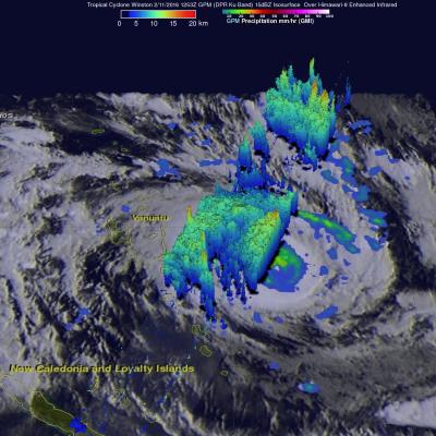
Intensifying South Pacific Tropical Cyclone Winston Viewed By GPM

Tropical cyclone activity has recently increased in the South Pacific Ocean. Four tropical cyclones have formed in this area in 2016. The GPM core observatory satellite had an excellent view of tropical cyclone Winston on February 11, 2016 at 1253 UTC. Winston was located east of Vanuatu with tropical storm force winds of about 55 kts when GPM passed over head. Winston's rainfall was measured by GPM's Microwave Imager (GMI) and Dual-frequency Precipitation Radar (DPR) instruments. GPM's radar data revealed that Winston was dropping rain at a rate of over 60 mm (2.4 inches) per hour on the

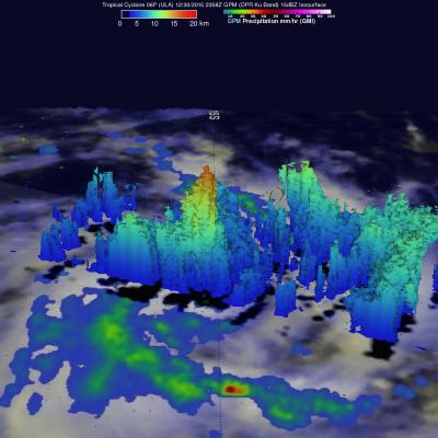
GPM Sees More Powerful Tropical cyclone 06P (ULA)

The GPM core observatory satellite had an excellent daytime view of tropical cyclone 06P (ULA) on December 30, 2015 at 2358 UTC. The tropical cyclone had moved to the east-southeast of Samoa in the South Pacific Ocean with maximum sustained winds increasing to about 50 kts (58 mph). The rainfall pattern derived from GPM's Microwave Imager (GMI) and Dual-Frequency Precipitation Radar (DPR) instruments showed that 06P was much better organized. Powerful thunderstorms at the center of the tropical cyclone were found by DPR to be dropping rain at a rate of over 66 mm (2.6 inches) per hour. GPM's

Ian, First 2014 South Pacific Tropical Cyclone

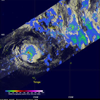
Tropical cyclone IAN became the first tropical cyclone of the 2013-2014 South Pacific season when it formed yesterday north of Tonga. The TRMM satellite passed above IAN this morning at 1133 UTC. IAN is a small tropical cyclone but TRMM's Precipitation Radar (PR) instrument found that IAN was dropping rain at a rate of over 113 mm/hr (~4.4 inches) in some areas. Since it was launched on November 27, 1997 TRMM's Precipitation Radar (PR) has been providing 3-D vertical profiles of rain and snow from the surface up to a height of about 12 miles (20 kilometers). A 3-D view of IAN's vertical

TRMM Sees South Pacific Tropical Cyclone 21P

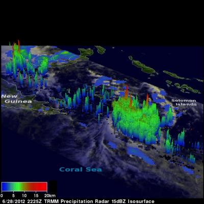
The South Pacific hurricane season normally ends in April but tropical cyclone 21P has developed in the South Pacific Ocean between Papua New Guinea and the Solomon Islands. The center of the tropical cyclone was directly beneath the TRMM satellite when it passed over on 28 June 2012 at 2225 UTC (~8:25 AM Local time). A rainfall analysis using data from TRMM's Microwave Imager (TMI) and Precipitation Radar (PR) instruments shows that the tropical cyclone, although small, was well organized and contained some intense convective storms dropping rainfall at a rate of over 50mm/hr (~2 inches). A 3