tropical cyclones

Tropical Cyclone Winston Hits Fiji

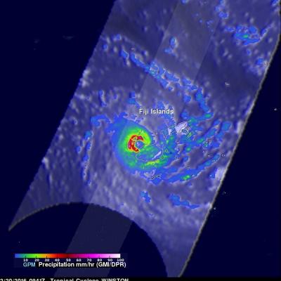
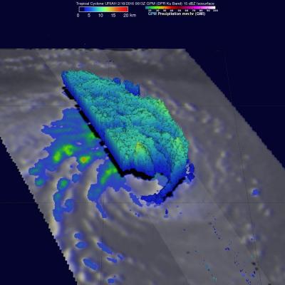
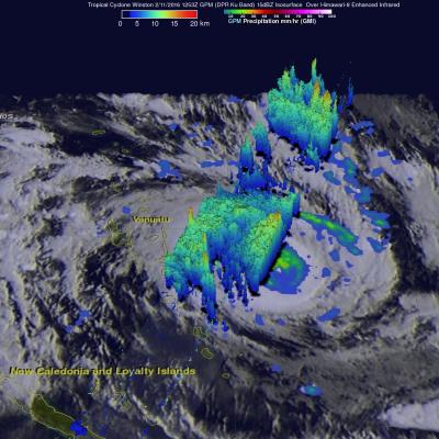
The GPM core observatory satellite flew directly above tropical cyclone Winston on February 20, 2016 at 0941 UTC. Tropical cyclone Winston had sustained winds estimated at 155 kts (178 mph) at that time. A rainfall analysis derived from data collected by GPM's Microwave Imager (GMI) and Dual-frequency Precipitation Radar (DPR) instruments found that in addition to powerful winds Winston was dropping rain at a rate of over 169 mm (6.7 inches) per hour in the western side of the eye. Tropical cyclone WINSTON is the most powerful storm to hit Fiji. At least one fatality has already occurred. The

GPM Again Examines Powerful Tropical Cyclone Uriah

Both yesterday and today the GPM core observatory satellite had excellent views of tropical cyclone Uriah in the South Indian Ocean. Uriah was intensifying with winds of about 115 kts (132 mph) on February 17, 2016 at 1651 UTC when the GPM satellite passed above. A rainfall analysis derived from GPM's Microwave Imager (GMI) and Dual-frequency Precipitation Radar (DPR) data collected with that pass revealed that Uriah had a well defined circular eye. Rain was measured by DPR falling at a rate of over 179 mm (7 inches) per hour on the southern side of Uriah's eye wall. GPM passed over again on

GPM Examines Tropical Cyclone Uriah

Over the past view days the GPM core observatory satellite has had good looks at tropical cyclone URIAH in the South Indian Ocean west of Australia. On February 15, 2016 at 1706 UTC GPM flew directly over the center of the tropical cyclone and measured rainfall in a well defined circulation. GPM's Dual-frequency Precipitation Radar (DPR) instrument discovered that rain was falling at a rate of over 127 mm (5 inches) per hour in a band of intense storms south of the cyclone's center. When GPM's Radar sliced through tropical storm URIAH on February 15, 2016 it also found that the intense

Intensifying South Pacific Tropical Cyclone Winston Viewed By GPM

Tropical cyclone activity has recently increased in the South Pacific Ocean. Four tropical cyclones have formed in this area in 2016. The GPM core observatory satellite had an excellent view of tropical cyclone Winston on February 11, 2016 at 1253 UTC. Winston was located east of Vanuatu with tropical storm force winds of about 55 kts when GPM passed over head. Winston's rainfall was measured by GPM's Microwave Imager (GMI) and Dual-frequency Precipitation Radar (DPR) instruments. GPM's radar data revealed that Winston was dropping rain at a rate of over 60 mm (2.4 inches) per hour on the

GPM Views Tropical Cyclone Forming Near Madagascar

The GPM core observatory satellite flew over a forming tropical cyclone in the South Indian Ocean between Madagascar and Reunion on February 8, 2016 at 2137 UTC. Low vertical wind shear will assist in the evolution of the tropical low as it moves slowly toward the southwest. Rainfall derived from GPM's Microwave Imager (GMI) and Dual-frequency Precipitation Radar (DPR) data revealed that powerful convective storms near Madagascar's eastern coast were found to be dropping rain at a rate of over 94 mm (3.7 inches) per hour. 3-D measurements were made of convective storm tops with GPM's radar

GPM Flies Over Dissipating Tropical Cyclone Corentin

Tropical cyclone Corentin was the first named tropical cyclone of 2016 in the South Indian Ocean. Corentin caused little danger because it's genesis, maturation and dissipation have all occurred over the South Indian Ocean about equidistant from the distant shores of Madagascar and Australia. The GPM core observatory satellite flew over Tropical Cyclone Corentin on January 25, 2016 at 1306 UTC. High vertical wind shear was starting to take it's toll on the increasingly disorganized tropical cyclone. Rainfall collected by GPM Microwave Imager (GMI) and Dual-frequency Precipitation Radar (DPR)

Developing Tropical Cyclone Viewed By GPM

The GPM core observatory satellite saw a tropical cyclone developing in the South Indian Ocean east of Madagascar on January 21, 2016 at 0146 UTC. GPM's Microwave Imager (GMI) and Dual-frequency Precipitation Radar (DPR) measured precipitation in the potential tropical cyclone. The most intense showers were shown by the GMI instrument to be dropping rain at a rate of over 71 mm (2.8 inches) per hour in strong storms to the northeast of the tropical low's center of circulation. GPM's radar (DPR) viewed a swath of data to the west of the developing tropical cyclone center where rain was measured

GPM 2015: One Year of Storms

Submitted by JacobAdmin on Mon, 01/11/2016
Video Embed

As we enter the new year, take a look back at the snowstorms, tropical storms, typhoons, hurricanes and floods captured and analyzed by the Global Precipitation Measurement (GPM) mission from around the globe during 2015. 

The complete list of storms by date and location are as follows:

1. New England Nor’easter – January 26 – New England, USA
2. Snowstorm – February 17 – Kentucky, Virginia and North Carolina, USA
3. Tornadic Thunderstorms in Midwest – March 25 – Oklahoma and Arkansas, USA

<iframe width="490" height="276" src="https://www.youtube.com/embed/oiGzKmfOvkg?rel=0" frameborder="0" allowfullscreen></iframe>
As we enter the new year, take a look back at the snowstorms, tropical storms, typhoons, hurricanes and floods captured and analyzed by the Global Precipitation Measurement (GPM) mission from around the globe during 2015. The complete list of storms by date and location are as follows: 1. New England Nor’easter – January 26 – New England, USA 2. Snowstorm – February 17 – Kentucky, Virginia and North Carolina, USA 3. Tornadic Thunderstorms in Midwest – March 25 – Oklahoma and Arkansas, USA 4. Typhoon Maysak – March 30 – Yap Islands, Southwest Pacific Ocean 5. Rain Accumulation from Cyclone...
Powerful Tropical Cyclone Ula Monitored By GPM JacobAdmin Mon, 01/11/2016
Tropical cyclone ULA's winds peaked at 115 kts (132 mph) over the weekend. These high winds meant that for a couple days ULA was a category four tropical cyclone on the Saffir-Simpson Hurricane Wind Scale. ULA moved over the waters of the North Fiji Basin between the Fiji Islands and New Caledonia before moving southeastward into the South Fiji Basin. The GPM core observatory satellite had good looks at powerful tropical cyclone ULA during it's changes in intensity. On January 8, 2015 at 2216 UTC GPM saw that rain was falling at a rate of over 63.5 mm (2.5 inches) north of the intensifying