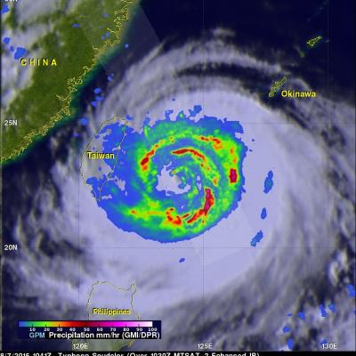
GPM Reveals Very Strong Thunderstorms in Typhoon Choi-Wan
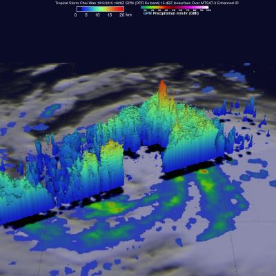
The GPM core observatory satellite flew above tropical storm Choi-Wan on October 5, 2015 at 1828 UTC and then saw Choi-Wan again as a hurricane on October 6, 2015 at 0448 UTC. The tropical cyclone was spreading clouds and rain over a large area of the northwest Pacific Ocean southeast of Japan. GPM discovered that Choi-Wan's organization had slightly improved. GPM's Microwave Imager (GMI) and Dual-Frequency Precipitation Radar (DPR) instruments were able to peer through the overcast and reveal the locations of rainfall bands within the tropical cyclone. GMI found several areas where Choi-Wan