GPM

GPM content

Powerful Hurricane Ophelia Seen Heading Toward Ireland

The GPM core observatory passed directly above hurricane Ophelia on October 14, 2017 at 1656 UTC. Ophelia was a powerful category three on the Saffir-Simpson hurricane wind scale with sustained winds of close to 115 mph (100 kts). GPM's Microwave Imager (GMI) and Dual-Frequency Precipitation Radar (DPR) instruments collected data showing the locations of extremely heavy rainfall with the hurricane. GPM's radar unveiled intense downpours in the northeastern side of Ophelia's eye that were dropping rain at the extreme rate of over 8.4 inches (213 mm) per hour. Other intense feeder bands with
GPM Catches Hurricane Nate's Landfall
NASA's GPM satellite helped track Nate's progress through the Gulf of Mexico and also captured Nate's landfall on the north central Gulf Coast. This animation shows instantaneous rainrate estimates from NASA's Integrated Multi-satellitE Retrievals for GPM or IMERG product over North America and the surrounding waters beginning on Thursday October 5th when Nate first became a tropical storm near the northeast coast of Nicaragua in the western Caribbean until its eventual landfall on the northern Gulf Coast on Sunday October 8th.

Rainfall In Southeast Asia Analyzed By GPM

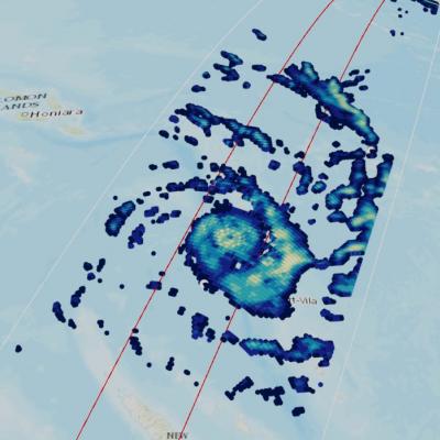
Tropical storm Khanun formed northeast of the Philippines on October 12, 2017. The GPM core observatory satellite passed above Khanun on October 13, 2017 (0656 UTC) when maximum sustained wind speeds had reached about 45 kts (~52 mph). Khanun had passed over the northern Philippines and was moving into the South China Sea. The approximate location of Khanun's center of circulation is shown with a red tropical storm symbol. The intensifying tropical storm's rainfall is shown in this image courtesy of data collected by GPM's Microwave Imager (GMI) and Dual-Frequency Precipitation Radar (DPR)

TRMM Level 2-Level 3 GPROF Processing Announcement

With the completion of the TRMM era GPM constellation version 8 level 1 processing, PPS will start to process the TRMM era MHS, SSMIS, AMSR2 and ATMS version 8 level 2 and level 3 GPROF products on Monday October 16, 2017. Similar to the TRMM version 8 level 1 constellation products, all level 2 and level 3 GPROF products will be produced as GPM version V05, all products are in HDF5 format, all product names will use the GPM file naming convention: https://pps.gsfc.nasa.gov/Documents/FileNamingConventionForPrecipitatio… and the produced data will appear both in STORM

Replacement GPM Ka/Ku L1B products (2017-10-11) for orbit 20566

PPS received replacement GPM Ka/Ku L1B products from JAXA and will reprocess the affected data including Level 2 and 3 data. If you have already obtained products with orbit# 20566 from our archive or through a standing order, etc., please discard and use the replacement products. PPS has replaced the following GPM Ka/Ku L1B data: GPMCOR_KAR_1710111422_1555_020566_1BS_DAB_05A.h5 GPMCOR_KUR_1710111422_1555_020566_1BS_DUB_05A.h5 PPS will reprocess the affected downstream L2/L3 products shortly. 2AKa 2A.GPM.Ka.V7-20170308.20171011-S142252-E155525.020566.V05A.HDF5 2AKu 2A.GPM.Ku.V7-20170308

Strengthening Tropical Storm Ophelia Observed By GPM

On Monday October 9, 2017 at 1100 AM AST (1500 UTC) tropical depression seventeen (TD17) was upgraded to tropical storm Ophelia. The tropical storm is located over the open waters of the the eastern Atlantic southwest of the Azores. The GPM core observatory satellite had a good view of tropical storm Ophelia on October 10, 2017 at 2:46 PM AST (1846 UTC). GPM's Microwave Imager (GMI) and Dual-Frequency Precipitation Radar (DPR) revealed that the storm was organized but most of the rainfall in the storm was only of light to moderate intensity. The area covered by GPM's 151.9 mile wide (245 km)

GPM Sees Powerful Thunderstorms In Landfalling Hurricane Nate

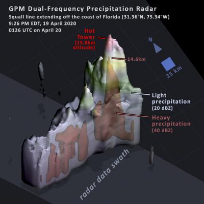
The GPM core observatory satellite passed above powerful thunderstorms within land falling hurricane Nate on October 8, 2017 at 4:41 AM EDT (0841 UTC). GPM's Dual-Frequency Precipitation Radar (DPR) found that a few storms over southwestern Alabama were dropping rain at the extreme rate of greater than 4 inches (102 mm) per hour. This 3-D slice by GPM's radar (DPR Ku Band) shows the structure of precipitation within the powerful thunderstorms near the center of hurricane Nate. A few thunderstorms over Alabama were found by GPM's radar to have tops reaching heights above 10.5 miles (17 km).

Artifacts in Early and Late IMERG for 9-10 October

Starting with the first orbit of 9 October 2017, the MHS data from NOAA-19 began displaying substantial artifacts. After the orbit crossing 00 UTC 10 October, the NOAA-19 data have been embargoed from Early and Late IMERG, although it took until 03 UTC for all artifacts to age off the morphing. At this point, Early and Late IMERG appear nominal, except they lack the sampling that NOAA-19 provides.

GPM Examines Forming Tropical Storm Nate (TD16)

The GPM core observatory satellite passed above forming tropical storm Nate (TD16) on October 5, 2017 at 5:46 AM EDT (0946 UTC). TD16 was located in the western Caribbean near the coast of Nicaragua with winds of about 34.5 mph (30 kts). Data received by GPM's Microwave Imager (GMI) and Dual-Frequency Precipitation Radar (DPR) shows bands of rain producing heavy rainfall East of TD16's center of circulation. Downpours in the Caribbean Sea East of Nicaragua were measured by GPM's Radar (DPR Ku Band) dropping rain at a rate of over 6.4 inches (162 mm) per hour. This close-up 3-d cross section
Intense Hurricanes Seen From Space
In 2017, we have seen four Atlantic storms rapidly intensify with three of those storms - Hurricane Harvey, Irma and Maria - making landfall. When hurricanes intensify a large amount in a short period, scientists call this process rapid intensification. This is the hardest aspect of a storm to forecast and it can be most critical to people's lives. While any hurricane can threaten lives and cause damage with storm surges, floods, and extreme winds, a rapidly intensifying hurricane can greatly increase these risks while giving populations limited time to prepare and evacuate.