Active Eastern & Central Pacific Hurricane Season
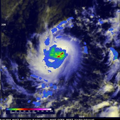
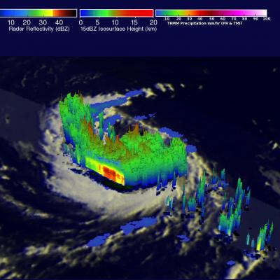
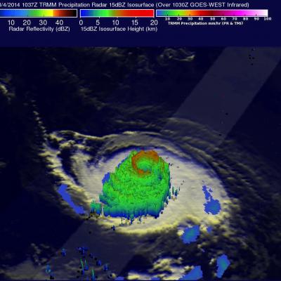
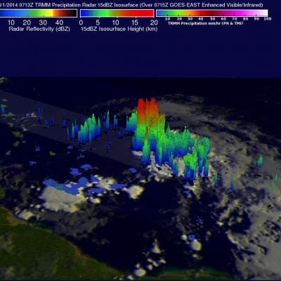
Tropical cyclones are frequently forming during this active hurricane season in the eastern and central Pacific ocean. As hurricane Julio was fading in the central Pacific Ocean north of Hawaii, hurricane Karina was forming on August 13, 2013 off the Mexican coast. The TRMM satellite passed directly above the center of intensifying tropical storm Karina on August 14, 2014 at 1927 UTC. A rainfall analysis that used data from TRMM's Microwave Imager (TMI) is shown overlaid on a GOES-WEST image received at 1930 UTC. TRMM TMI showed that storms near Karina's center were dropping rain at a rate of