Western India's Intense Monsoon Rain
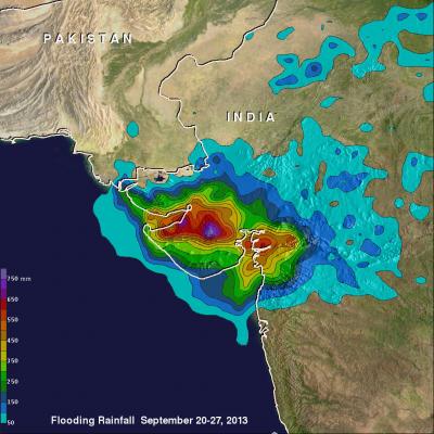
Western India has been having intense monsoon rainfall since September 21, 2013. This has resulted in widespread flooding in the west Indian state of Gujarat and reports of at least three related deaths. India had record breaking flooding in the northern state of Uttarakhand in June 2013 with more than 6,000 people killed. Near real-time TRMM Merged HQ/Infrared Precipitation (3B42) data were used in the rainfall analysis above. Rainfall total estimates from these space satellite data for the seven day period from September 20-27, 2013 were used. The highest totals of almost 800mm (~31.5 inches