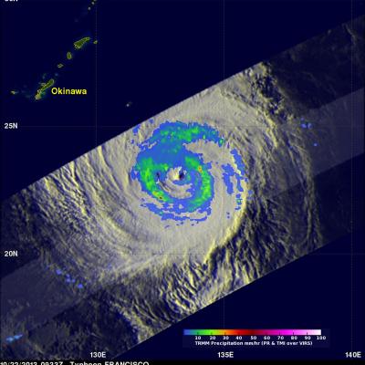
Typhoon Haiyan (31w) Develops East Of The Philippines
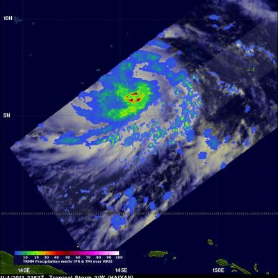
The Joint Typhoon Warning Center (JTWC) predicts that typhoon HAIYAN (31W) that developed east of the Philippines will become dangerous super typhoon HAIYAN with winds of 130kts (~150mph) before it hits the southern Philippines in about three days. The TRMM satellite had a good daytime view when it flew above tropical storm HAIYAN (31W) yesterday evening on November 4, 2013 at 2353 UTC. This image shows precipitation data collected with TRMM's Microwave Imager (TMI) and Precipitation Radar (PR) instruments overlaid on a combination visible and infrared image from TRMM's Visible and InfraRed