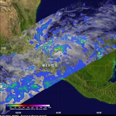
Hurricane Ingrid Heads For Mexico
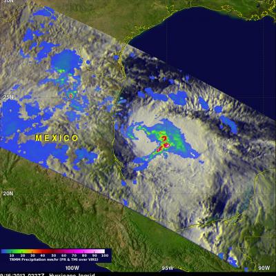
The TRMM satellite flew over on September 16, 2013 at 0227 UTC (10:57 PM September 16) when Ingrid was still a hurricane in the Gulf Of Mexico. Data collected by TRMM's Microwave Imager (TMI) and Precipitation Radar (PR) instruments show that rain was falling at a rate of over 100mm/hr (~4 inches) in strong storms near Ingrid's center.