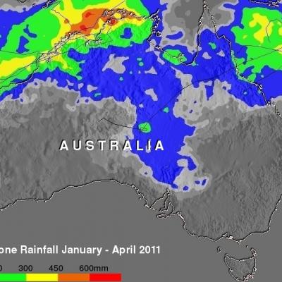
2011 a Wet Spring for the Central US
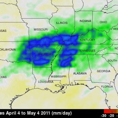
A combination of heavy rains and a large snow melt has put parts of the central US at risk for record flooding this spring with several locations along the Mississippi already at or near record levels. One likely culprit is La Nina. Despite the fact that the current La Nina appears to be winding down, it's effects in the atmosphere can persist for a while. Furthermore, although not every La Nina brings major flooding to the region, La Nina's are conducive for above-normal rainfall from East Texas and northern Louisiana up through Arkansas and the Tennessee and Ohio Valleys with below-normal