TRMM Over Tropical Cyclone 18S
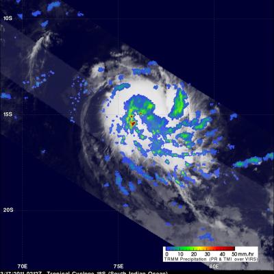
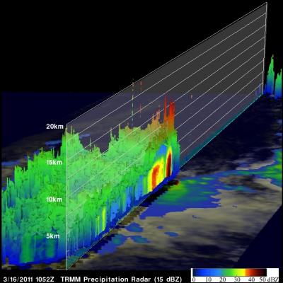
On 17 March 2011 at 0212 UTC the TRMM satellite passed over tropical cyclone 18S that had formed and was intensifying in the open waters of the South Indian Ocean. 18S was already well organized and TRMM's Precipitation Radar (PR) showed that powerful thunderstorm towers were located near 18S' center of circulation. These towers know as chimney clouds release a lot of energy and can serve to strengthen a tropical cyclone. 18S is expected to attain strong tropical storm intensity with wind speeds of at least 55 kts (~63 mph) in the next three days.