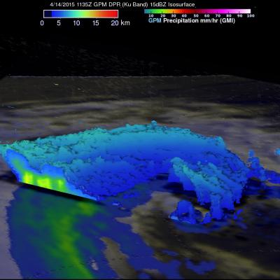
Typhoon Noul Beginning to Strengthen in the West Pacific
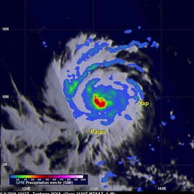
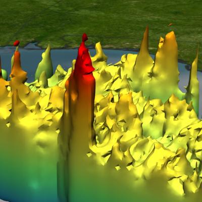
Since its formation as a tropical depression 3 days ago, Typhoon Noul has taken on a general westward motion while steadily working its way across the central-west Pacific. During this time, the system passed over Yap where it brought heavy rain and strong gusty winds. Thus far, Noul has been only slowly strengthening, becoming a minimal typhoon just one day ago. That appears likely to change, however, as the system now seems poised to intensify as it passes well north of Palau in the genearal direction of the Philippines. NASA's GPM Core observatory satellite captured this image of Noul as it