Eastern Pacific Tropical Cyclone Forming
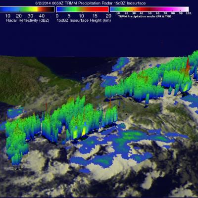
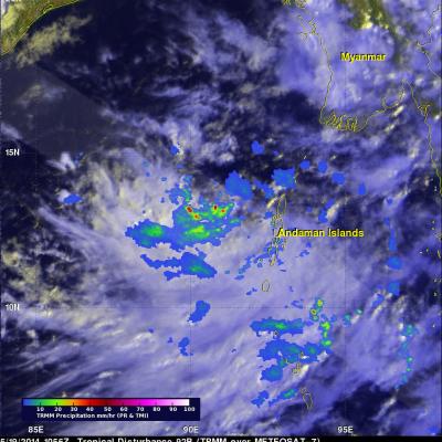
The eastern Pacific Ocean has become active on cue with the start of the hurricane season in that area. Only a few days after hurricane Amanda weakened and disappeared the National Hurricane Center (NHC) says that development of another tropical cyclone is probable southeast of Salina Cruz, Mexico. The image above shows rainfall data captured by the TRMM satellite as it flew over on June 2, 2014 at 0659 UTC. TRMM's Microwave Imager (TMI) and Precipitation Radar (PR) data are shown overlaid on an enhanced infrared image from the GOES-EAST satellite received at 0645 UTC. TRMM found areas of