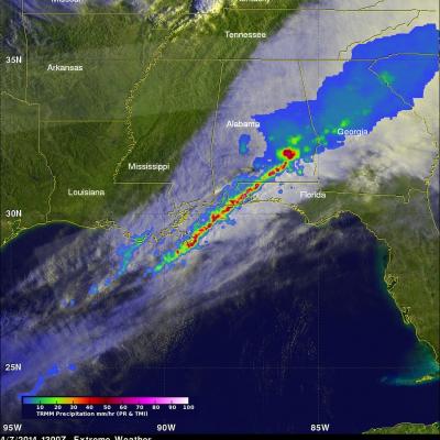
Deadly Tornadoes Hit Southern States For Second Day
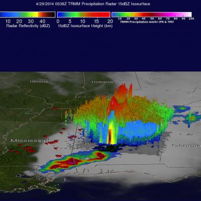
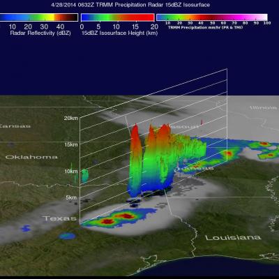
For the second day in a row deadly tornadoes hit the the southern United States. Mississippi was the hardest hit with nine people killed by tornadoes that hit Tupelo. The TRMM satellite had two good views as extreme weather continued moving through the area on Monday April 28, 2014 at 11:00 PM CDT (April 29, 2014 at 0400 UTC) and early Tuesday April 29, 2014 at 00:38 AM CDT (0538 UTC). Rainfall derived from TRMM's Microwave Imager (TMI) and Precipitation Radar (PR) data is shown overlaid on GOES-EAST infrared satellite images captured on April 29, 2014 at 0402 UTC and 0532 UTC. Red symbols