Tropical Cyclone Hellen
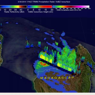
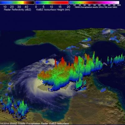
Tropical cyclone HELLEN formed in the Mozambique channel northwest of Madagascar on March 28, 2014. HELLEN became a very powerful tropical cyclone with peak sustained winds of 130kts (about 150 mph) on March 30, 2014. HELEN's eye came ashore in northwestern Madagascar On March 31, 2014 with winds predicted to be about 95kts (~109 mph). HELEN is now expected to gradually weaken over northwestern Madagascar while moving southwestward and be over the Mozambique Channel again on April 1, 2014. The TRMM satellite passed above HELLEN on March 30, 2014 at 1747UTC when the tropical cyclone was close