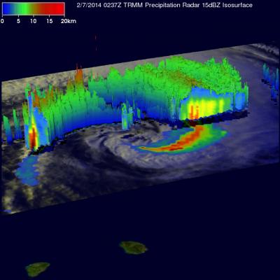
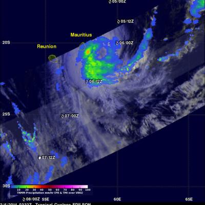
TRMM Sees Tornadic Thunderstorms
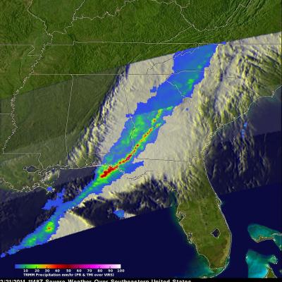
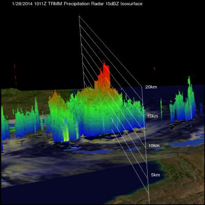
The TRMM satellite passed above a line of severe thunderstorms over the eastern United States on February 21, 2014 at about 1148UTC (6:48 AM EST). Several reports of tornadoes in Illinois were associated with this system yesterday. A possible tornado was reported in Georgia this morning. The 3-D image below shows a TRMM Precipitation Radar (PR) slice through the line of severe thunderstorms. One tall thunderstorm in the Florida panhandle was shown reaching heights of about 13.8km (~8.5 miles) and returning Radar reflectivity values of over 58dBZ to the satellite. Rain was found by TRMM PR to