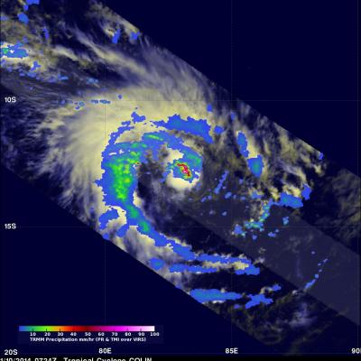
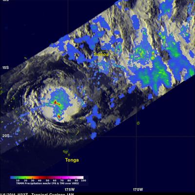
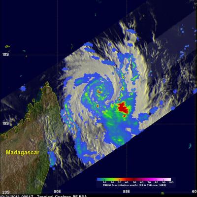
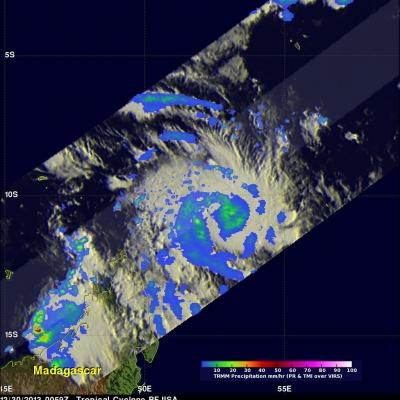
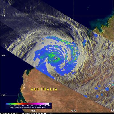
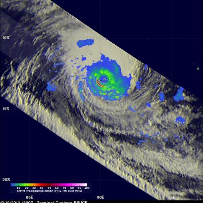
TRMM's Sees Deadly Ian Hitting Tonga
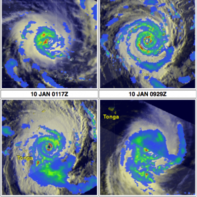
Tropical cyclone IAN meandered in an area of the Pacific Ocean between Fiji and Tonga as it intensified from tropical storm intensity with winds of 35kts (~41 mph) on January 5, 2014 to a deadly tropical cyclone with winds of 125kts (~144 mph) on January 11, 2014. Tropical cyclone IAN caused extensive damage and an unknown number of deaths when it passed through Tonga at the peak of it's intensity. The TRMM satellite provided excellent coverage of IAN with multiple passes directly above the tropical cyclone. Rainfall data collected by TRMM's Microwave Imager (TMI) and Precipitation Radar (PR)