Powerful Hurricane Arthur Hits North Carolina
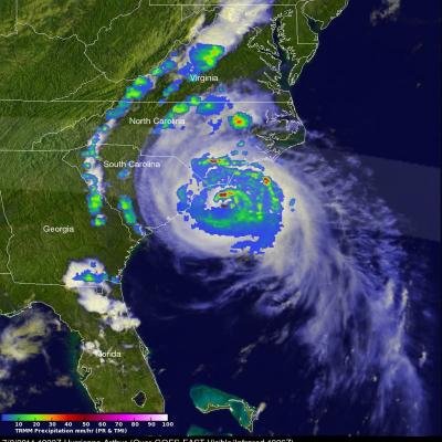
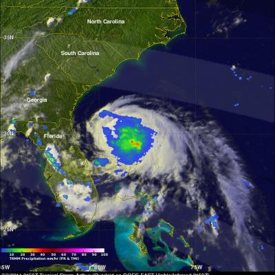
Hurricane Arthur battered North Carolina after coming ashore late last night at 0315 UTC (11:15 PM EDT). The TRMM satellite flew directly over Arthur on July 3, 2014 at 1922 UTC ( 3:22 PM EDT) as the hurricane was becoming increasingly more powerful. An analysis of rainfall from TRMM's Microwave Imager (TMI) and Precipitation Radar (PR) instruments was overlaid on a 1926Z GOES-EAST Visible/Infrared image. Intense bands of thunderstorms north of Arthur's well defined eye were revealed by TRMM to be dropping rainfall at a rate of over 98.4 mm ( about 3.9 inches) per hour. One of the TRMM