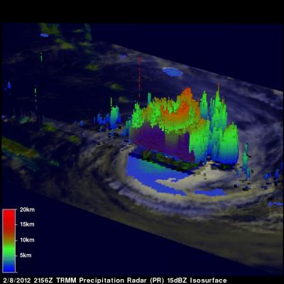
The TRMM satellite traveled directly above tropical cyclone Jasmine in the south Pacific Ocean on 8 February 2012 at 2156 UTC. Jasmine was classified as a powerful category 4 on the Saffir Simpson Scale with wind speeds of 115 kts (~132 mph) at it's peak intensity but had started to weaken at the time of this pass. Rainfall from TRMM's Microwave Imager (TMI) and Precipitation Radar (PR) instruments showed that intense storms in bands around Jasmine's large circular eye were dropping rainfall at a rate of over 50mm/hr (~2 inches). This was a daytime pass so the rainfall analysis was overlaid on
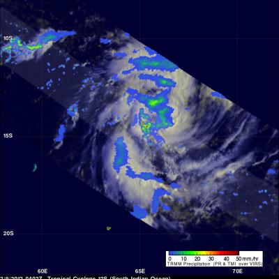
The TRMM satellite passed above a developing tropical cyclone in the South Indian Ocean designated as 12S on 9 February 2012 at 0402UTC. A rainfall analysis derived from TRMM's Microwave Imager (TMI) and Precipitation Radar (PR) is shown overlaid on a visible/infrared image from TRMM's Visible and InfraRed Scanner (VIRS) instrument. This TRMM view shows that the storm was already well organized. TRMM's PR shows that heavy rainfall of over 50 mm/hr (~2 inches) was occuring in storms near center of the circulation. Some of the powerful storms dropping this rainfall were shown by TRMM to reach