GPM Sees Powerful Storms With Advancing Monsoon

The GPM core observatory satellite passed over the Bay Of Bengal on May 23, 2017 at 0251 UTC. GPM flew almost directly above very strong convective storms that were located east of Sri Lanka. These powerful storms were associated with the approaching South-West monsoon. The amount and timing of monsoon rainfall is very important to the economy of India. GPM's Microwave Imager (GMI) and Dual-Frequency Precipitation Radar (DPR) instruments collected data that showed the location and intensity of rainfall in the southern Bay Of Bengal. Very heavy rainfall was detected within this cluster of

IMERG Sees Record Australia Rainfall

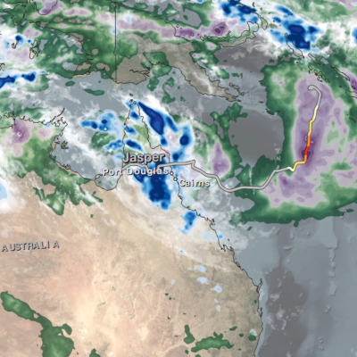
Over the past week extreme rainfall has drenched northeastern Australia. This is the heaviest rainfall in that area since tropical cyclone Debbie hit Queensland Australia in late March. Much of the recent extremely heavy rainfall was due to storms associated with a trough of low pressure slowly moving over northeastern Queensland from the Coral Sea. More than 100mm (3.9 inches) of rain in 24 hours was reported near Townsville in northern Queensland. A trough of low pressure moving eastward from central Australia has also been encroaching into western Queensland. This analysis of rainfall over

Heavy Rainfall In The Caribbean Measured By IMERG

Heavy rainfall has recently caused widespread flooding and landslides in Jamaica. Occasional showers from trade winds are normal in Jamaica but recent rainfall from slow moving troughs have been unusually heavy. A 1009 mb low pressure center located in the western Caribbean was disrupting the normal trade winds over Jamaica today. This rainfall analysis was constructed using data from NASA's Integrated Multi-satelliE Retrievals for GPM (IMERG). Data collected in near-real time were utilized in IMERG's rainfall accumulation estimates for the Caribbean. This analysis covers the period from May

PPS Releases GPM V05 DPR L1-L3 and Combined L2- L3 Data

PPS is releasing GPM V05 DPR L1-L3 and Combined L2 and L3 V05 data products today, Wednesday May 17, 2017. This V05 data will be available beginning with May 01, 2017 data and forward. The DPR Level 3 monthly products will be released when validated. Reprocessed V05 DPR and Combined data for March 2014 through April 2017 will take several weeks to complete. This data will appear in PPS's arthurhou archive as we reprocess (6 to 8 weeks - estimated completion time). Registered users can obtain data from: ftp://arthurhou.pps.eosdis.nasa.gov/ and can order this through STORM: https://storm.pps

Tropical Cyclone Donna's Extreme Rainfall Evaluated With IMERG

On May 10, 2017 rapidly dissipating tropical Cyclone Donna moved to the southeast of New Caledonia in the South Pacific. In addition to being the most powerful out-of-season tropical cyclone ever recorded in the southern hemisphere, Donna also dropped extreme amounts of rainfall along it's path. Donna spread heavy rainfall along it's path from northern Vanuatu through the Loyalty Islands east of New Caledonia. Over 250mm (~10 inches) of rainfall was reported in the islands of northern Vanuatu as Donna was moving through on May 5, 2017. This rainfall analysis was constructed using data from