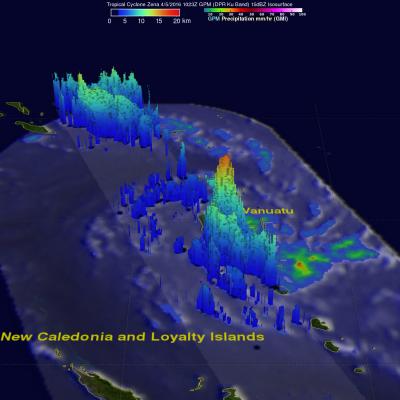
First Images from GPM Microwave Imager

First Images from GPM Microwave Imager
Image Caption
First Images from GPM Microwave Imager

The image shows rain rates across a 550-mile (885 kilometer) wide swath of an extra-tropical cyclone observed off the coast of Japan on March 10, 2014. Red areas indicate heavy rainfall, while yellow and blue indicate less intense rainfall. In the northwest part of the storm in the upper left of the image, the blue areas indicate falling snow.

Learn More

Gillian Has Second Life

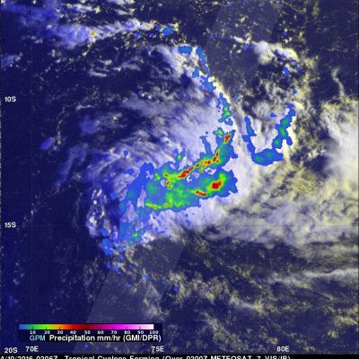
Tropical cyclone Gillian re-generated in the South Indian Ocean south of Indonesia on March 21, 2014. Gillian had peak wind speeds of about 140 kts (about 173 mph) on March 23, 2014 making it a Category 5 hurricane on the Saffir-Simpson Scale. The TRMM satellite flew above GILLIAN when the tropical cyclone was intensifying on March 23, 2014 at 0304 UTC. Data from TRMM's Microwave Imager (TMI) and Precipitation Radar (PR) instruments were used in the rainfall analysis on the above left. TRMM PR revealed that Gillian had very intense storms in a well defined eye wall producing rain at a rate of

GPM Performs Yaw Turn, Continues Calibration

On March 17, the team executed GPM's first scheduled yaw turn to turn the orientation of the spacecraft 180 degrees. Yaw is the left/right orientation in the horizontal plane of the spacecraft's motion. The spacecraft is now "flying backwards." Yaw maneuvers will be performed approximately every 40 days for spacecraft thermal control, as the angle between the spacecraft's orbit and the sun changes. This keeps the side of the spacecraft that is designed to remain cold from overheating. Yaw maneuvers are performed primarily using the spacecraft's reaction wheels. March 19, the team performed a

Gillian's Persistent Remnants

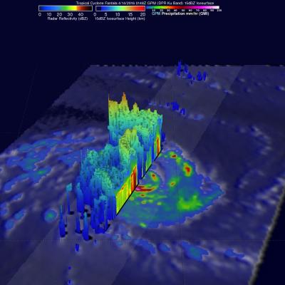
The persistent remnants of tropical cyclone GILLIAN have moved westward over 2700km (about 1674 miles) since forming in the Gulf Of Carpentaria on March 8, 2014. GILLIAN's coherent remnants were located just to the southeast of the Indonesian island of Java when the TRMM satellite flew over on March 20, 2014 at 0415 UTC. TRMM's Precipitation Radar (PR) instrument revealed that intense convective storms in this area were still dropping rain at a rate of over 97 mm/hr (about 3.8 inches) and returning radar reflectivity values of over 51dBZ. TRMM PR data were used in the simulated 3-D view on the

Tropical Cyclone Gillian's Remnants

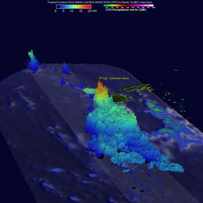
Over the past few days former tropical cyclone GILLIAN's remnants moved from the Gulf Of Carpentaria into the Timor sea . The TRMM satellite found a few strong convective thunderstorms when it passed above these remnants on March 18, 2014 at 0431 UTC. TRMM's Precipitation Radar (PR) instrument measured rain falling at a rate of over 86 mm/hr (~3.4 inches) in some intense storms. The simulated 3-D image above was made using TRMM PR data and shows that several of the tallest thunderstorms in GILLIAN's remnants were reaching heights of over 15.75 km (~9.8 miles). Radar reflectivity values of over