TRMM And GPM See Typhoon Maysak

The TRMM satellite has been collecting valuable scientific data since November 1997. Early today the satellite collected rainfall data from recently formed typhoon Maysak as it flew directly above on March 30, 2015 at 0414 UTC. This image shows rainfall data collected with this orbit by TRMM's Microwave Imager (TMI) and Precipitation Radar (PR) instruments. With sustained winds of over 85 kts (98 mph) Maysak was a category two typhoon on the Saffir-Simpson hurricane wind scale. A little over eight hours later the GPM core observatory satellite also viewed typhoon Maysak on March 30, 2015 at

Tornadoes Hit Southwest

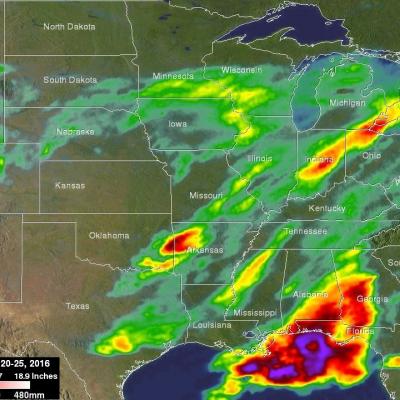
Seven Tornadoes were reported yesterday in a line of violent thunderstorms extending over Oklahoma and Arkansas. One death was reported in a tornado that hit near Tulsa, Oklahoma. The TRMM satellite flew over this line of deadly storms on March 25, 2015 at 11:21 CDT ( March 26, 2015 at 0321 UTC). The first image shows a rainfall analysis that was formed from data collected by TRMM's Microwave Imager (TMI) and Precipitation Radar (PR) instruments at the time of this pass. TRMM PR data indicated that rain was falling at the extreme rate of over 172 mm (6.8 inches) per hour in some powerful