GPM Satellite Sees a Windstorm over Norway

GPM Satellite Sees a Windstorm over Norway
Image Caption
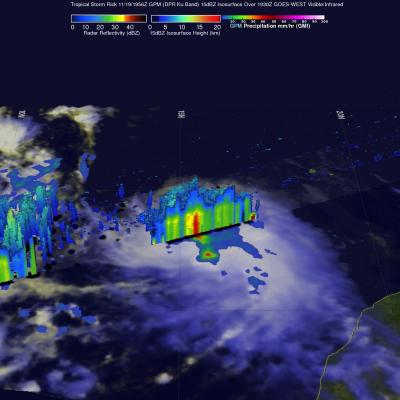
On September 26, the Global Precipitation Measurement (GPM) satellite flew over an extra-tropical cyclone whose center was approaching Norway. The Norwegian weather service reported that this storm brought gale-force winds to parts of Norway's coast.

Extra-tropical cyclones this strong or stronger are a regular feature of northern European winters. The particularly damaging ones are called "windstorms." Borrowing a page from hurricane forecasters, some weather agencies in affected countries name these storms. In fact, one such naming system called the September 26 extra-tropical cyclone "Irina" (Institute for Meteorology at the Free University of Berlin, http://www.met.fu-berlin.de/adopt-a-vortex/tief/).

Tropical Storm Rachel

Tropical depression 18E, located southwest of Mexico, became tropical storm Rachel on September 24, 2014 at 1500 UTC (8 PM PDT). The TRMM satellite had a good view of Rachel when it flew over early today at 0608 UTC (September 25, 2014 at 11:08 PM PDT). A precipitation analysis that used TRMM's Microwave Imager (TMI) data is shown overlaid on a 0600Z GOES-WEST enhanced infrared image. This image shows that, due to northeasterly wind shear, convective precipitation was located southwest of of Rachel's center of circulation. The heaviest rain was shown falling at a rate of over 50mm (amost 2

Tropical Depression 18E Forms

Tropical cyclones have continued to form in the eastern Pacific Ocean at a faster rate than last year. This morning at 8 AM PDT (1500 UTC) a low pressure center south of Mexico was upgraded to a tropical depression (18E). The TRMM satellite crossed over the forming tropical depression on September 23, 2014 at 0729 UTC (00:20 AM PDT). TRMM's Precipitation Radar (PR) instrument found that rain was falling at a rate of almost 61 mm (2.4 inches) per hour near the low's center of circulation. Radar reflectivity values of over 51 dBZ were analyzed in some heavy showers by TRMM PR. This simulated 3-D

Hurricane Odile Rainfall Totals

During the past week hurricane Odile and remnants have produced heavy rainfall that caused dangerous flooding over the Baja California peninsula and the southwestern United States. Rainfall from Odile may be welcomed in the Southwest where some areas have been experiencing extreme to exceptional drought conditions. The Tropical Rainfall Measuring Mission or TRMM satellite was launched in November 1997 with the primary mission of measuring rainfall in the Tropics using a combination of passive microwave and active radar sensors. The rainfall analysis above was made using real-time TRMM Multi

Hurricane Edouard Headed for Cooler Waters

Edouard, which became the fifth named storm of the season after forming on the night of September 11th (EDT) west of the Cape Verde Islands, continued to strengthen as it made its way through the central Atlantic this past week, reaching hurricane intensity on the 14th before becoming the first major hurricane of the season when it peaked briefly as a category 3 storm on the 16th with sustained winds reported at 100 knots (~115 mph) by the National Hurricane Center (NHC). Fortunately, the storm has not posed a threat to the US East Coast due to the presence of a deep-layer trough along the