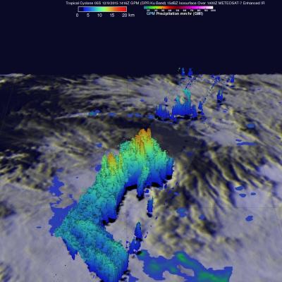
Print resolution still of Typhoon Phanfone being scanned through the center of the DPR data showing the inner volumetric rain rates. Note: Tokyo is immediately to the left of the scan.
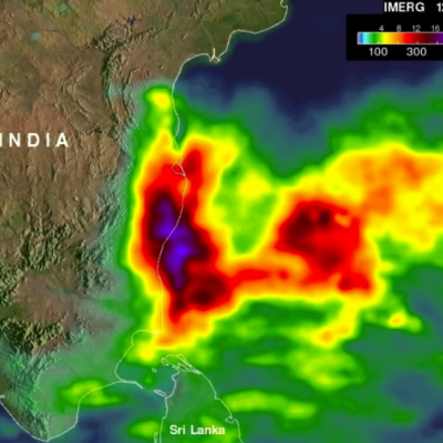
Cyclone Hudhud, which reached the equivalent of a category 4 hurricane on the US Saffir-Simpson scale over the Bay of Bengal, weakened slightly before making landfall Sunday morning (local time) on the central southeast coast of India near the port city of Visakhapatnam. Hudhud came ashore with wind gusts of up to 120 mph and so far is being blamed for 24 fatalities in India. The TRMM-based, near-real time Multi-satellite Precipitation data (TMPA) analysis is used to monitor rainfall over the global Tropics. A TMPA rainfall analsis for the period 7-14 October 2014 over India and the
The TRMM satellite flew over intensifying cyclone Hudhud in the Bay Of Bengal on October 10, 2014 at 0945 UTC.A Rainfall analysis from TRMM's Microwave Imager (TMI) instrument and Hudud's track is shown here. Cyclone Hudhud's is predicted to become a powerful category three tropical cyclone (on the Saffir-Simpson hurricane scale) with sustained winds peaking at 100 kts (115 mph) before hitting India's east coast in a couple days.
Vongfong was a super typhoon with wind maximum sustained winds of 145 kts (167 mph) when the TRMM satellite flew over on October 8, 2014 at 2328 UTC. Vongfong was the most powerful typhoon since super typhoon Haiyan that killed over 6,000 people after hitting the Philippines in November 2013. In the first image TRMM's Microwave Imager (TMI) shows that Vongfong was producing rainfall over a large area with heavy rainfall revealed in the eye wall and in multiple feeder bands. The small animation shows typhoon Vongfong's rainfall being overlaid on a MTSAT Visible/Infrared image. The Joint Typhoon
The most accurate and comprehensive collection of rain, snowfall and other types of precipitation data ever assembled now is available to the public. This new resource for climate studies, weather forecasting, and other applications is based on observations by the Global Precipitation Measurement (GPM) Core Observatory, a joint mission of NASA and the Japan Aerospace Exploration Agency (JAXA), with contributions from a constellation of international partner satellites. The GPM Core Observatory, launched from Japan on Feb. 27, carries two advanced instruments to measure rainfall, snowfall, ice