Italy's Extreme Rainfall Examined With IMERG
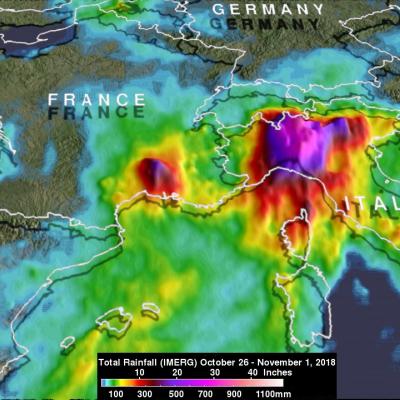
During the past week a strong low-pressure system moving through southern Europe battered, drenched and flooded Italy. It caused flooding, landslides and other damage to large areas of the country. The deaths of at least 11 people have been attributed to this stormy weather. High winds knocked down many trees and heavy rainfall from these storms contributed to flooding in large areas of Italy. Venice was inundated when heavy rain fell and a surge of water from the Adriatic Sea was pushed into the city by the storm's very high winds. Data from various satellites, that cover most of the globe