Gulf Coast

GPM overpass of Hurricane Delta
The 2020 Atlantic hurricane season will go down as one of the most active seasons on record, currently second only to the incredible 2005 season in terms of the number of named storms. The 2020 season is only the second time in recorded history (the other being 2005) that the Greek alphabet has been used because the number of named storms has exceeded the number of regular names on the list. Another interesting aspect of the 2020 season has been the number of storms that have struck the northern Gulf Coast. So it is no surprise that the latest storm, Hurricane Delta, would also find its way to

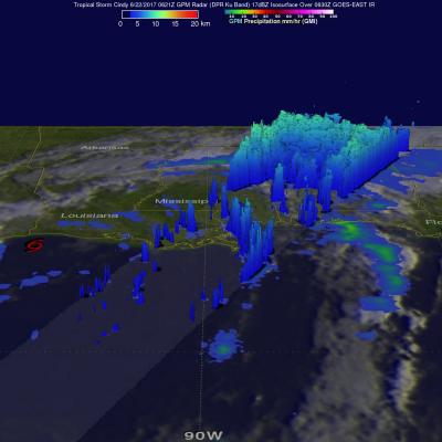
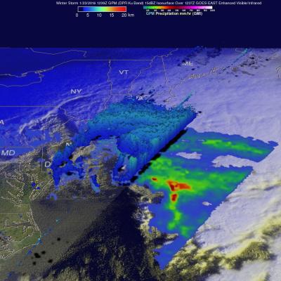
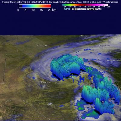
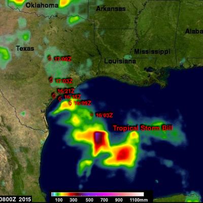
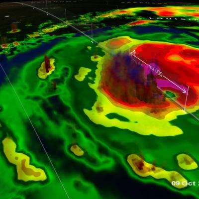
NASA's IMERG Shows Cindy's Extreme Rainfall

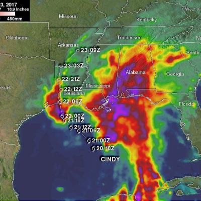
Tropical storm Cindy was downgraded to a tropical depression after moving onshore near the Texas and Louisiana Border on Thursday June 22, 2017. Flooding was reported along the the Gulf Coast even before Cindy made landfall. The rainfall around tropical storm Cindy was asymmetrical. The majority of heavy rainfall with the tropical cyclone was located east of Cindy's center in the states along the Gulf Coast from Louisiana through the Florida Panhandle. The tropical depression continued to spread heavy rain and occasionally severe thunderstorms after it came ashore. Severe thunderstorms spawned

GPM Satellite Sees Cindy Drenching Gulf Coast

The GPM core observatory satellite passed above as tropical storm Cindy was approaching the western Louisiana coast on June 22, 2017 at 1:21 AM CDT (0621 UTC). Cindy had maximum sustained winds of about 40 kts (46 mph) at that time. A red tropical storm symbol shows Cindy's approximate location. Rainfall derived from Microwave Imager (GMI) and Dual-Frequency Precipitation Radar (DPR) measurements showed that there was very little rainfall near Cindy's center of circulation but bands of moderate to heavy showers are shown moving into the states along the Gulf Coast. GPM's Radar (DPR Ku Band)

Tornado Spawning Storms Examined By GPM Satellite

On Wednesday May 24, 2017 severe weather affected a large area of the eastern United States. Tornadoes were reported in Florida, Georgia, South Carolina, North Carolina and Ohio. The GPM core observatory satellite flew above a line of tornado spawning storms that were moving through the Florida panhandle on May 24, 2017 at 10:26 AM EDT ( 1426 UTC). GPM's Microwave Imager (GMI) and Dual-Frequency Precipitation Radar (DPR) instruments collected data showing that very heavy downpours were accompanying some of these storms. The violent storms moving through the Southeast were strong but GPM's

Deadly Flooding Gulf Coast Rainfall Measured By NASA's IMERG

An extremely severe rainfall event hit the states of Louisiana and southern Mississippi when a very slow moving low pressure system continuously pulled tropical moisture from the Gulf Of Mexico. Measurements by the GPM core observatory satellite showed that rainfall intensity within the low pressure system actually increased on August 12, 2016 as the low settled over southeastern Louisiana. At least 4 people have died in record flooding after the unusually heavy rainfall starting falling last week. More than 27 inches (686 mm) of rain have been reported in the area. This is the second time

Extreme Rainfall Along the Gulf Coast Measured by IMERG

For the better part of a week, a persistent, mid-level area of low pressure has been tapping into warm, moist air to produce stormy weather in the northeastern Gulf Of Mexico. The National Hurricane Center (NHC) monitored this stormy area for possible development but unfavorable upper-level winds and the close proximity to land prevented development into a tropical system. However, during the past week from as much as 4 to over 15 inches (254-381 mm) of rain fell along the Gulf Coast from Tampa northward through the Big Bend to as far west as central Louisiana. So far the highest rainfall
Storm Brings Heavy Precipitation to Northeast
UPDATE 1/23/2016 5:00pm ET On January 23, 2016 at 1239 UTC (7:39 AM EST) the GPM core observatory passed above the deadly winter storm that was burying the Northeast under a deep layer of snow. As GPM passed above a band of snow was shown approaching the island of Manhattan. The winter storm was predicted to dump near record snowfall in New York city. GPM's Microwave Imager (GMI) and Dual-frequency Precipitation Radar (DPR) instruments showed massive amounts of moisture being transported from the Atlantic Ocean over states from New York westward through West Virginia. GPM's Radar instruments...

Weakening Tropical Storm Bill Seen By GPM

The GPM core observatory satellite had a good daytime look at tropical storm Bill on Wednesday June 17, 1015 at 1552 UTC ( 10:52 AM CDT). GPM saw that an area of heavy rain on Bills northern side was then moving into southern Oklahoma. The Dual-Frequency Precipitation Radar (DPR) on board the satellite measured rain dropping at a rate of over 50 mm (almost 2 inches) per hour in some intense storms. GPM radar data (Ku band) were also used to look at the 3-D structure and storm top heights within storms associated with tropical storm Bill. This image shows that in some areas the dissipating

IMERG Sees Gulf Rainfall With Tropical Storm Bill

Tropical storm Bill became the second named tropical cyclone in the Atlantic Ocean Basin when it formed in the western Gulf Of Mexico on June 16, 2015. Data from the NASA's Integrated Multi-satellitE Retrievals for GPM (IMERG) was used in this analysis to estimate rainfall from Tropical Storm Bill. Precipitation was analyzed from the time when tropical storm Bill was forming in the Gulf Of Mexico on Monday June 15, 2015 until early this morning at 0800 UTC (4 AM CDT). The storm was dropping heavy rainfall over Texas this morning but this analysis indicates that the heaviest rainfall totals, up