Interactive visualization by Matt Lammers (KBRwyle / NASA GSFC)

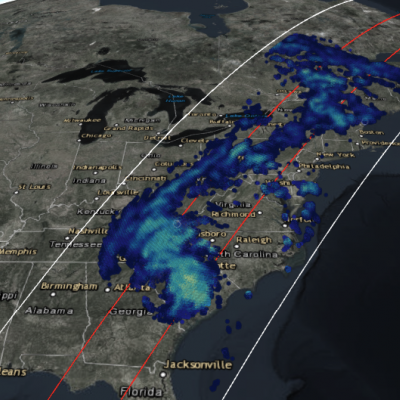
GPM Views Downgraded Hurricane Michael Soaking the Eastern U.S.

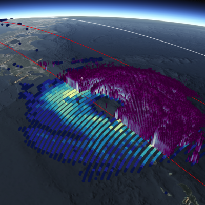
View fullscreen in STORM Event Viewer Hundreds of miles way from its landfall in Mexico Beach, Florida, Michael has been downgraded to a tropical storm, but it continues to pack a punch. Waterlogged regions of the Carolinas from Hurricane Florence are seeing trees toppled in the gusty winds, while rain falling in the Appalachian Mountains is leading to flash flooding and water rescues. Widespread power outages and flooding remain likely as the storm moves to the northeast through the rest of the day.

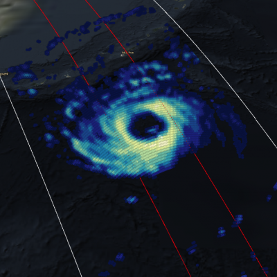
GPM Views Cat. 2 Typhoon Trami Moving Towards Japan

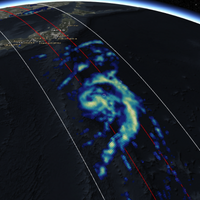
View fullscreen in STORM Event Viewer Once a Category 5 Super Typhoon, Trami has become rooted in place due to a lack of steering flow. This has caused the storm to deplete the warm waters beneath it and it has since weakened to a Category 2 with maximum winds of 90 knots. It maintains a broad eye and once it begins moving again, is likely to reintensify at least somewhat as it zooms northeastward over the Ryukyu Islands and into the southern coast of Japan. Wind impacts are likely to be exacerbated by its forward speed and current forecasts expect it to have widespread impacts in a region

GPM View Hurricane Rosa in the Eastern Pacific

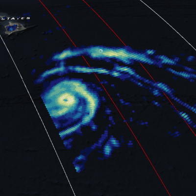
The GMI overflight here shows a clear center of circulation with much of the intense convection on the south side of Hurricane Rosa, a Category 1 storm with winds of 75 knots. It is expected to continue intensifying over the next couple days before it runs into strong shear and cooler waters off the Baja California coast. Forecasts suggest it will make landfall in Northern Baja as a tropical storm, with its primary impacts being heavy rainfall and flash flooding over the Desert Southwest.

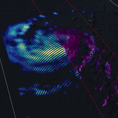
GPM Views Super Typhoon Jebi Twice

UPDATE 8/31/18 View Fullscreen in STORM Event Viewer Having peaked in intensity, Typhoon Jebi is a Category 5 Super Typhoon with maximum winds estimated around 142 knots. It is beginning an eyewall replacement cycle with a gap between the outer and inner eyewalls appearing somewhat in the DPR. The storm's strength is expected to fluctuate but remain well above Category 3 for the next two days before it turns northward toward Japan. It will likely have widespread impacts on Southern Honshu in around 4 days time, an area that has already struggled with rainfall, typhoons, and intense heat this

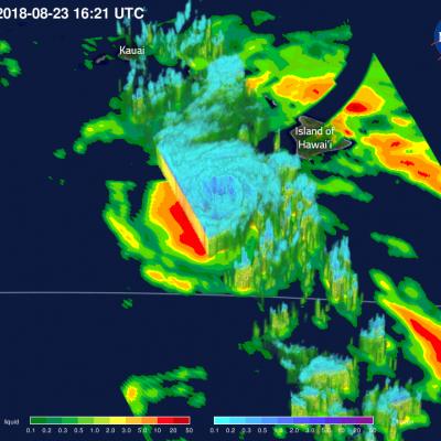
GPM Captures Cat. 4 Hurricane Lane Passing Close to Hawaiian Islands

View Fullscreen in STORM Event Viewer Battling increased vertical shear, Hurricane Lane struggles northward, down from its Category 5 peak but still featuring winds of over 110 knots. The storm has already begun impacting the Hawaiian Islands, bringing over a foot of rain to Hilo via its outer bands. Lane is expected to continue northward, approaching the island chain, before slowly veering westward as it continues to lose strength. This weakening will not diminish its likely primary impacts, which will be intense coastal erosion and damage and torrential rainfall, upwards of 30 inches in some

GPM Views Hurricane Lane Approaching Hawaii

View Fullscreen in STORM Event Viewer Direct strikes on Hawaii by tropical cyclones are relatively rare, but Hurricane Lane is poised to buck that trend if the models are to be believed. At the time of this overflight, Lane had maximum sustained winds of 130 knots and featured a symmetrical eye in the GMI data with intense precipitation rates on both east and west sides of the tight circulation. Its impacts are likely to start with flooding, especially on the island of Hawaii. High surf and strong winds will also have an impact, although the locations of maximum intensity will be determined by

GPM Views "Truck-Tire" Eyewall of Typhoon Soulik

View Fullscreen in STORM Event Viewer Avoiding Kyushu, Typhoon Soulik instead barrelled toward the Northern Ryukyu islands, with the 'truck-tire' eyewall impacting Amami (in the south) and Yakushima (in the north) Islands in this overflight. It featured winds approaching 100 knots as it moved northwestward. Soulik is expected to recurve toward the western coast of Korea, where it is likely to have devastating impacts to the majority of the peninsula depending on its ability to maintain intensity.

GPM Sees Hurricane Lane Threatening Hawaiian Islands With Heavy Rainfall

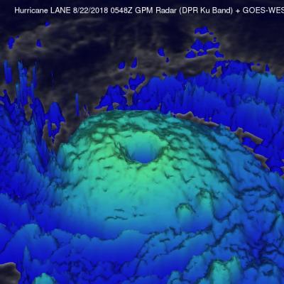
The GPM core observatory satellite flew over hurricane LANE on August 21, 2018 at 7:48 PM PST (August 22, 2018 at 0548 UTC). At that time LANE was located about 316 nautical miles (585.2 km) from Hilo, Hawaii. Hurricane LANE is one of the strongest tropical cyclones to move into the Hawaiian Islands. At the time of this GPM pass LANE was a category five on the Saffir-Simpson hurricane wind scale with winds of about 140 kts (161 mph). This analysis shows precipitation derived from data collected by the GPM satellite's Microwave Imager (GMI) and Dual-Frequency Precipitation Radar (DPR)

GPM Flies Over Typhoon Jongdari Twice in Two Days

7/27/18 Having both deepened in central pressure and broadened in precipitation shield, Jongdari is steadily intensifying as it churns towards the southern coast of Japan. In this overflight, the storm has deep convection both near the eye itself and scattered throughout its outer bands, and its maximum sustained winds are approaching 90 knots. It is expected to further intensify over the next 24 hours, reaching Category 3 status before weakening slightly prior to making landfall south of Nagoya. Jongdari will bring heavy rains and strong winds to a heavily-populated region, including the

Typhoon Maria Makes Landfall

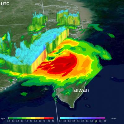
After striking the Ryukyu Islands of Japan and grazing Taiwan with torrential rains, Typhoon Maria made landfall just north of the populous city of Fuzhou, China with sustained winds of 95 knots and a broad shield of precipitation. The storm appears lopsided in the GMI, with much of the deep convection offshore, however, it is still likely to bring a brief period of flooding rains to this part of China before dissipating. View fullscreen in STORM Event Viewer