Energy

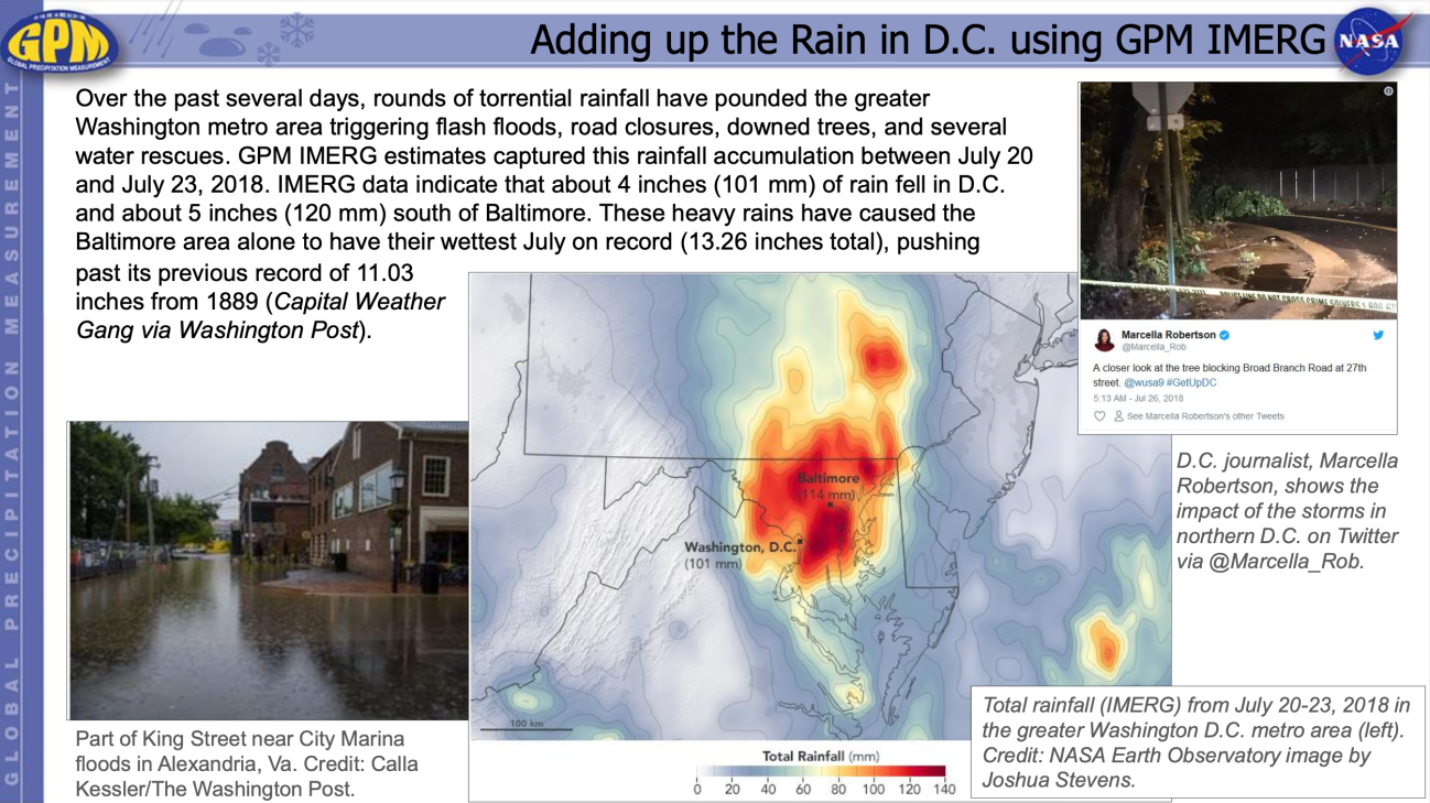
In many areas, energy infrastructure assets have suffered damage or disruption in services from a variety of climate-related impacts, such as extreme precipitation events, higher temperatures, drought, and rising sea levels. For example, warmer temperatures and little rainfall can cause changes in peak streamflow conditions that affect hydropower generation. Heavy precipitation events and flooding can impact a region’s energy infrastructures, including electric grid equipment, which has cascading effects on freshwater supplies and emergency services. The Energy Infrastructure and Management Applications area promotes the use of satellite precipitation data from the GPM constellation for key decisions or analyses within the energy sector, including the use of climatology data in the prediction of energy demand, development, harvest, and production of non/renewable energy resources, and load forecasting.

The NASA GPM Ground Validation Field Campaign at UConn took place in Storrs, Connecticut. The site has multiple instruments provided by the GPM Ground Validation Program. Credit: Diego Cerrai.
Though the last traces of winter are melting away and spring showers are in full swing across the U.S., the story of snow is not quite over for the season. In mid-April, two winter field campaigns involving NASA researchers are wrapping up, bringing with them unprecedented observations of snowfall. Understanding when, where, and how much snow is falling is critical for scientists and the public alike. In the short-term, accurate snowfall data can help weather forecasters prepare communities and plan against hazardous road conditions, power outages, and health risks. Over the long-term, these
Using the IMERG Long-term Precipitation Data for Applications
A long precipitation data set like the new GPM IMERG V06 product is valuable for many applications and for decision-making. Accurate and reliable precipitation records are not only crucial to understanding trends and variability but also for water management resources and food security, ecological management, and weather, climate and hydrological forecasting. Here we present a few highlights showcasing how GPM IMERG is helping a variety of end users make decisions that will benefit society for years to come. GPM IMERG Data Used for Wind Energy Map of average precipitation in north-central...