Missions

Overview The GPM Cold-season Precipitation Experiment (GCPEx) was conducted in cooperation with Environment Canada in Ontario, Canada from January 17th to February 29th, 2012. The overarching goal of GCPEx was to characterize the ability of multi-frequency active and passive microwave sensors to detect and estimate falling snow through the collection of microphysical property data, associated remote sensing observations, and coordinated model simulations of falling snow. Through collection of these unique datasets, GCPEx's goal is to improve the GPM snowfall retrieval algorithms. The GCPEx

PPS Announces Limited RETRO-Processing of L1-L3 F16 SSMIS as Version V05B for Apr 2015 through Jan 2018

Starting early the week of March 04, 2019 or shortly after ; PPS will be doing a limited RETRO-processing of Level 1 - Level 3 F16 SSMIS as Version V05B for the period of April 2015 through January 2018. Please see the table below for the specific products and dates affected. If you have previously obtained any of the data listed below, please discard these and replace this data with the retro-processed data as listed. +-------------------------+---------------------+---------------------+----------------+------------+ | DataType | Start of Data | End of Data | ProductVersion | # Granules | +-

Interruption of NOAA Products

Effective around 12:00 UTC 10 June the MHS and ATMS input to real-time IMERG suddenly became unavailable due to an unexpected change in NOAA protocols. While PPS scrambles to remedy the issue, the data content of the Early and Late Runs may be reduced for the next several days, meaning lower Quality Index due to longer morphing of microwave estimates and greater contributions by IR.

MHS NOAA-19 Data Processing Stop (PPS Will Resume NOAA-19 1C and GPROF Data)

PPS will resume to process NOAA-19 MHS L1C and GPROF products for the granules starting from 09/20/2019 10:22:10 UTC. There was an issue with the satellite drifting which caused issues with the pre-processing. NOAA/NESDIS updated the processing coefficient and made the NOAA-19 MHS channel 2 L1B data back to normal.
PPS Announcing Release of GPM L2-L3 CSH V06 Data Products JacobAdmin Wed, 11/27/2019
The Precipitation Processing System (PPS) has begun the TRMM and GPM Goddard Convective-Stratiform Heating (CSH) V06A level 2 and level 3 data reprocessing on, Monday October 21, 2019. This reprocessing will cover the whole life for TRMM and the period from the launch to current for GPM. The release notes (CHS V06) explaining the key changes from V05A and improvements implemented in the current V06A product will be available later this week and will be posted on the following PPS public web pages as soon as it's provided: https://pps.gsfc.nasa.gov/GPMprelimdocs.html https://pps.gsfc.nasa.gov

Replacement GPM Ka/Ku L1B products 2019-11-06 orbit# 32319

PPS will replace GPM Ka/Ku L1B products from JAXA and will reprocess the affected data including Level 2 and 3 data. If you have already obtained products with orbit#32319 from our archive or through a standing order, etc., please discard and use the replacement products when available. PPS will replace the following GPM Ka/Ku L1B data: GPMCOR_KUR_1911060353_0525_032319_1BS_DUB_05C.h5 GPMCOR_KAR_1911060353_0525_032319_1BS_DAB_05C.h5 PPS will reprocess the affected L2-3 downstream products. If you have obtained any of these products from our archive or through a Standing Order, etc., please

Early and Late IMERG IR Issues

Difficulties with accessing NOAA CPC 4-km Merged Global IR data resulted in the loss of IR data in IMERG Early Run for 12 November 12:00-21:30 UTC and 14 November 10:00-15 November 10:30 UTC, and in IMERG Late Run for 12 November 12:00-20:30 UTC and 14 November 10:00-15 November 09:30 UTC. Subsequently, the IR data were retrieved for use in the Final Run.
20 Years of IMERG - Resources
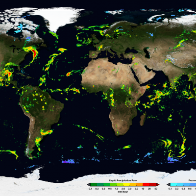
NASA Announces Long-term IMERG Satellite Record: A Near-Global 19-year Perspective on Rain and Snow NASA has just released its newest estimate of rain and snow covering the past 19 years. It's code name: Version 6 IMERG. NASA's IMERG -- the Integrated Multi-satellitE Retrievals for GPM -- combines information from whatever constellation of satellites are operating in Earth orbit at a given time, to estimate precipitation over the majority of the Earth's surface. This algorithm is particularly valuable over the majority of the Earth's surface that lacks precipitation-measuring instruments on...
Two Decades of Precipitation Measurement
NASA’s Precipitation Measurement Missions (PMM) have collected rain and snowfall from space for nearly 20 years, and for the first time in 2019, scientists can access PMM’s entire record as one data set. PMM includes two missions – the Tropical Rainfall Measuring Mission (TRMM), which orbited Earth from 1997 to 2015, and its successor, the joint NASA-JAXA Global Precipitation Measurement mission (GPM), which has been collecting data since 2014. This year, however, the GPM project upgraded its data algorithms to calibrate and incorporate TRMM data into its release, giving researchers, modelers...
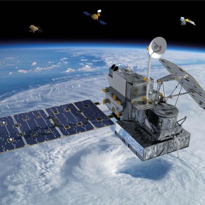
GPM flying over Earth with a data swath visualized.
Due to NASA network policies the NASA Precipitation Processing System (PPS) will be transitioning from FTP to FTPS for access to download GPM and TRMM data. As a result of this change, users may need to update the methods they use to download data. Due to these changes users will no longer be able to access the PPS FTPS servers using a web browser, and will need to connect using either the command line or dedicated file transfer software. One piece of software that can be used to connect to the new FTPS servers is Filezilla, which is free and open source, and is available on Mac, Windows, and...