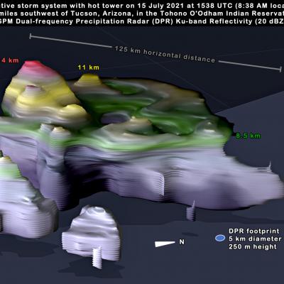
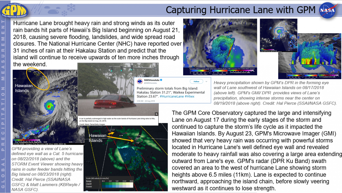
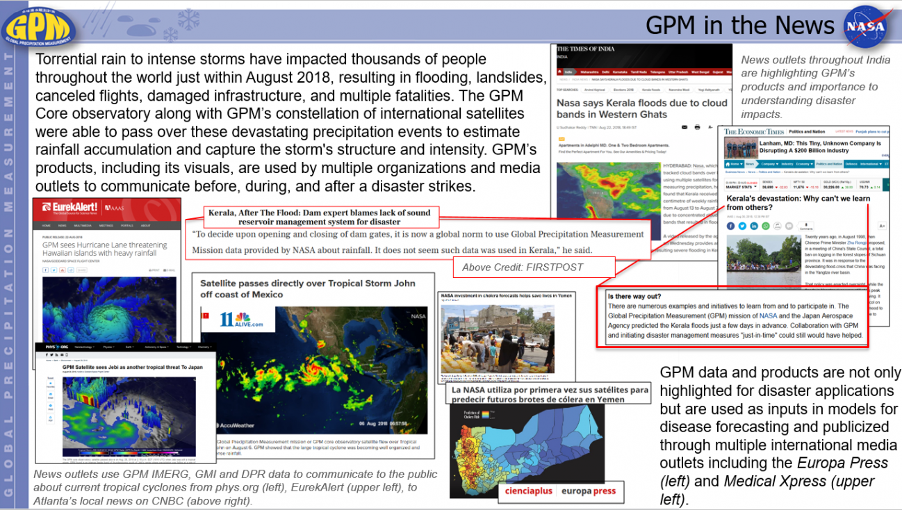
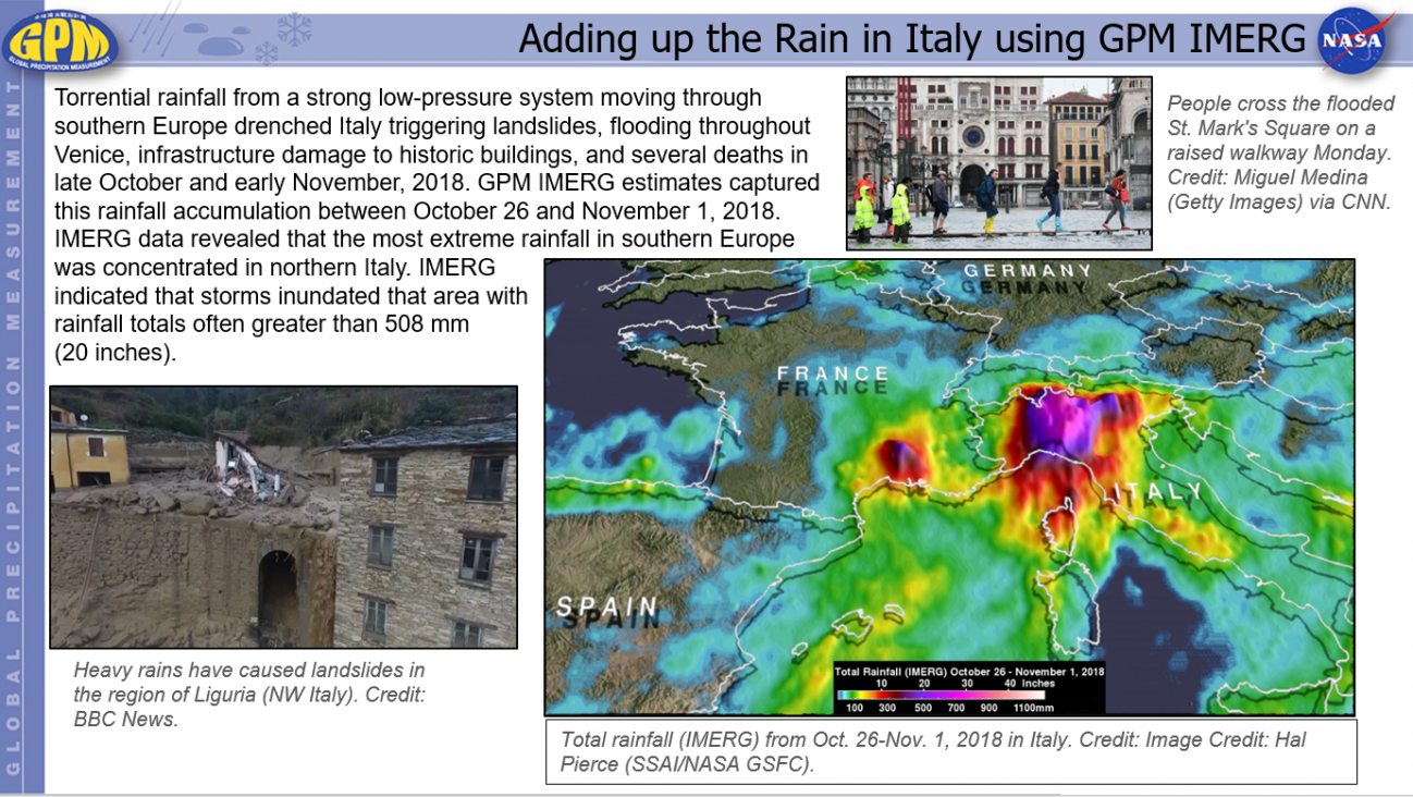
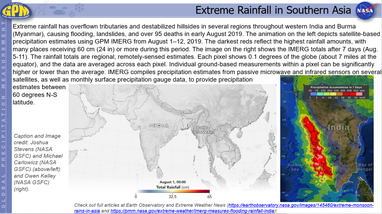
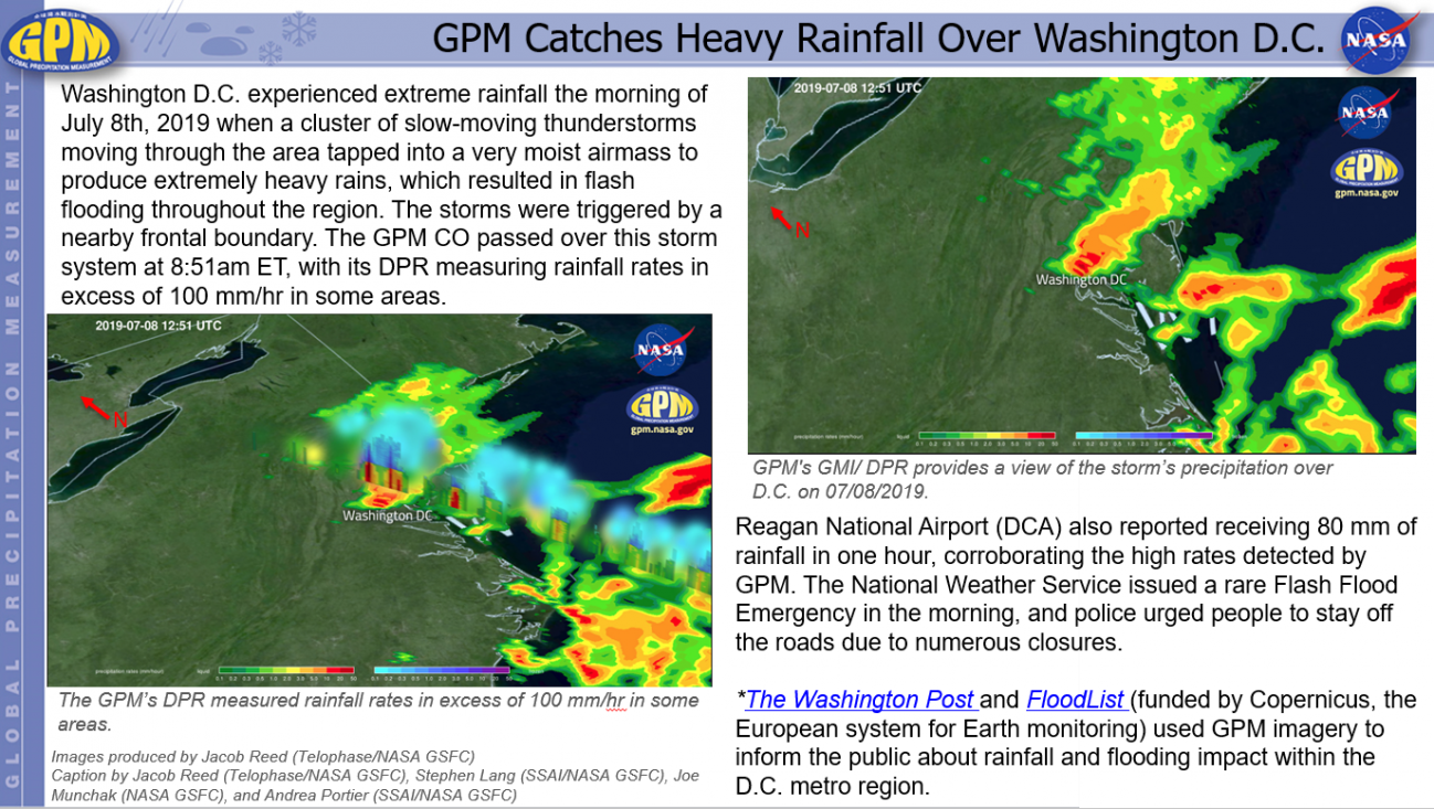
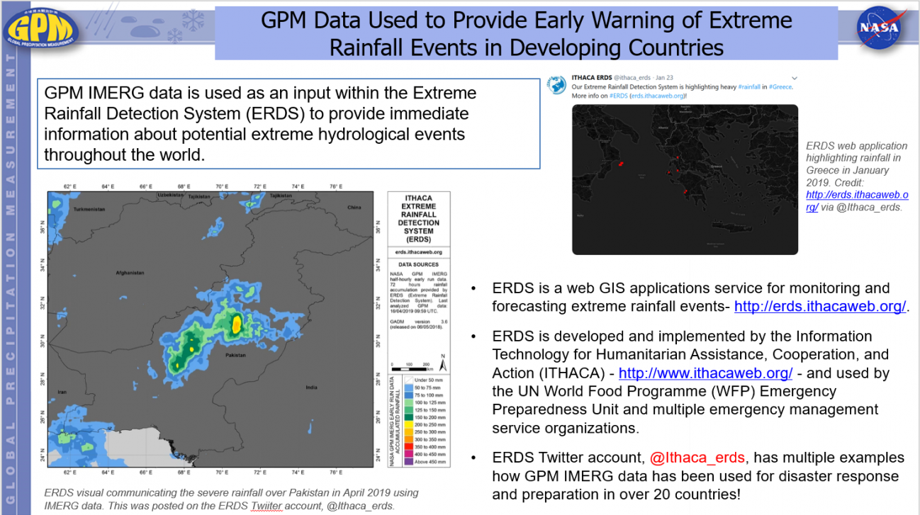
Severe Weather

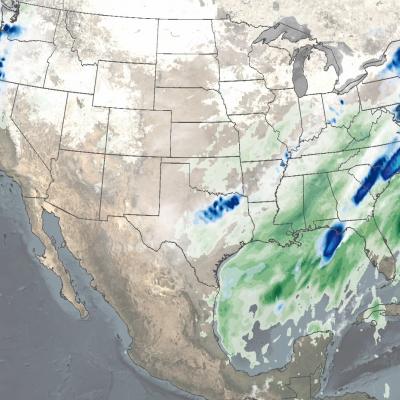
Many regions in the world experience severe weather such as thunderstorms, hail, tornadoes, and blizzards every year. Severe weather usually comes with heavy precipitation and causes unexpected hydrometeorological hazards, such as floods or landslides, which can affect thousands of people, posing a threat on life and property. T

Observing the Intertropical Convergence Zone with IMERG
The intertropical convergence zone or “ITCZ” roughly forms a band that circumnavigates the Earth near the Equator where the northeast trade winds in the Northern Hemisphere converge with the southeast trade winds in the Southern Hemisphere. Sailors have often referred to it as the “doldrums” due to its generally light winds. Yet, the ITCZ is an important part of the global circulation as it forms the ascending branch of the Hadley circulation. This is ultimately driven by incoming solar radiation, which peaks near the Equator. This warms the air and the ocean, causing warm buoyant air to rise...
GPM Sees Powerful Winter Storm Grayson
Powerful Coastal Storm Brings Snow, Extreme Cold, Wind and Blizzard Conditions to the East Coast View an interactive 3D visualization of GPM data from Winter Storm Grayson in STORM Event Viewer Mobile version Cold Artic air has been keeping the vast majority of the country east of the Rockies in the deep freeze over the past week. Now a powerful coastal storm is working its way up the East Coast bringing a mixture of snow, freezing rain, high winds and blizzard conditions from as far south as Florida all the way up into Maine with blizzard warnings in effect along the coast from North Carolina...
GPM Captures Hurricane Harvey's Rainfall
Music: "Whirlpool," Michael Jan Levine, Killer Tracks The Global Precipitation Measurement (GPM) Core Observatory captured these images of Hurricane Harvey at 11:45 UTC and 21:25 UTC on the 27th of August nearly two days after the storm made landfall as it was meandering slowly southeast at just 2 mph (~4 kph) near Victoria, Texas west of Houston. The image shows rain rates derived from GPM's GMI microwave imager (outer swath) and dual-frequency precipitation radar or DPR (inner swath) overlaid on enhanced visible/infrared data from the GOES-East satellite. Harvey's cyclonic circulation is...