

Super Typhoon Haiyan Hits the Philippines
Super typhoon Haiyan, equivalent to a Category 5 hurricane on the US Saffir-Simpson scale, struck the central Philippines municipality of Guiuan at the southern tip of the province of Eastern Samar early Friday morning at 20:45 UTC (4:45 am local time) as an extremely powerful super typhoon, perhaps the strongest ever recorded at landfall, with sustained winds estimated at 195 mph (315 kph) by the Joint Typhoon Warning Center. Previously, Hurricane Camille, which struck the northern Gulf Coast in 1969, held the record with 190 mph sustained winds at landfall. After striking Samar, Haiyan quickly crossed Leyte Gulf and the island of Leyte as it cut through the central Philippines.

TRMM captured this first image of Haiyan just as it was crossing the island of Leyte in the central Philippines. The image was taken at 00:19 UTC (8:19 am local) 8 November 2013 and shows the horizontal distribution of rain intensity within the Haiyan. Rain rates in the center of the swath are from the TRMM Precipitation Radar (PR), and those in the outer swath are from the TRMM Microwave Imager (TMI). The rain rates are overlaid on infrared (IR) data from the TRMM Visible Infrared Scanner (VIRS). TRMM shows that Haiyan still has a well-defined eye surrounded by a symmetric area of moderate rain (green annulus with a blue center) with several rain bands wrapping in from the south (green arcs). The symmetric rain area around the eye is a testament to the storm's intensity--the stronger the storm, the more the features are smeared uniformly around the center. At the time of this image, Haiyan's sustained winds were estimated to have dropped slightly to 160 knots (~185 mph) from crossing Leyte.
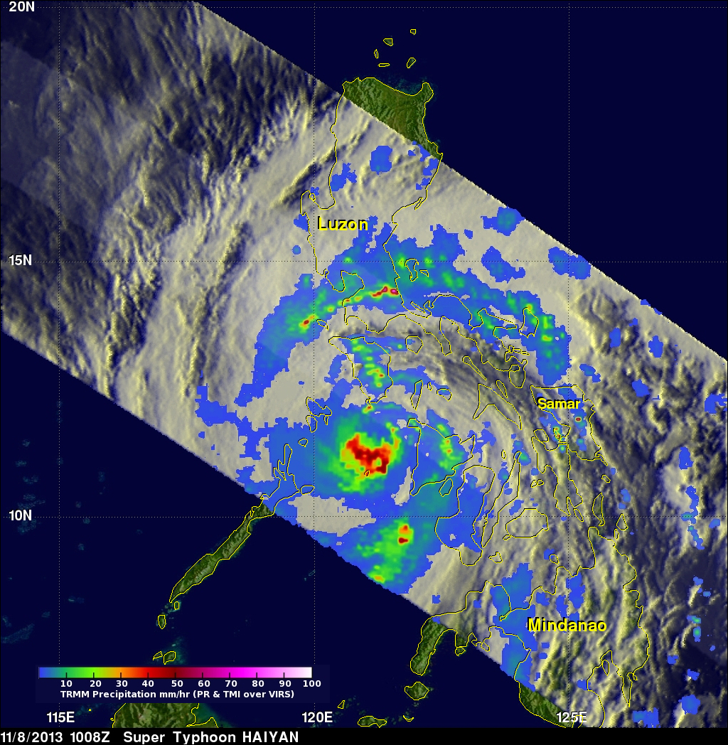
The second image was taken about 10 hours later at 10:08 UTC (6:08 pm local) when Haiyan was passing south of Mindoro as it was beginning to exit the Philippines. The center is now less organized after having passed over the larger Philippines island of Panay, although a large area of heavy rain (shown in red) is now located just south of the center. At the time of this image, Haiyan's intensity was estimated to be 145 knots (~167 mph), still equivalent to a Category 5 hurricane.
So far, four fatalities have been reported as a result of the storm, but these are preliminary as communication to many areas was knocked out. Haiyan is expected to continue moving in a general westward direction over the next 1 to 2 days before likely striking central Vietnam.
Click here to see a 512x512 animation that shows TMI/PR rain blending with TRMM's November 8, 2013 0019 UTC TRMM VIRS.
Click here for earlier information about Typhoon Haiyan.