TRMM News

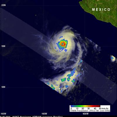
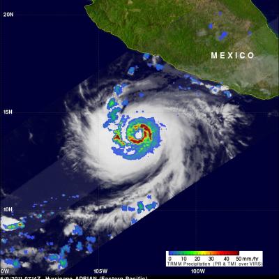
Tropical Storm BEATRIZ Forms Off Mexican Coast

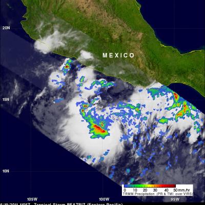
Tropical depression 02E was upgraded to tropical storm Beatriz on 19 June 2011 at 1800 UTC (1100 AM PDT). The TRMM satellite flew over on the same date at 1105 UTC( 0400 AM PDT) obtaining data used in the image shown above. Beatriz was already well organized with TRMM's Microwave Imager (TMI) and Precipitation Radar (PR) data showing that thunderstorms were dropping heavy rainfall in a large area near the center of the forming storm. PR data revealed that some of these powerful storms were reaching heights above 15 km (9.3 miles).

Another Tropical Cyclone Develops Near The Philippines

The sixth western Pacific tropical cyclone (06W) of 2011 has developed near the Philippines. Tropical storm AERE, super syphoon SONGDA and Tropical Storm SARIKA have already affected the Philippines this year. The TRMM satellite had an early morning look at the forming depression on 16 June 2011 at 2130 UTC. A precipitation analysis from TRMM's Microwave Imager (TMI) and Precipitation Radar (PR) shows that 06W wasn't well organized but contained areas of moderate to heavy rainfall located east of the Philippines. 06W is expected to intensify to a tropical storm, brush the northeastern coast of

TRMM Sees Adrian's Eye

Hurricane Adrian's eye was clearly seen by the TRMM satellite when it passed over on 10 June 2011 at 1608 UTC. The heavy rainfall completely surrounding Adrian's well defined eye was revealed with TRMM Microwave Imager (TMI) data obtained at the same time. Hurricane Adrain, located southwest Mexico , was classified as a dangerous category 4 on the Saffir-Simpson scale with sustained wind speeds estimated at 115 kts (~132 mph).

Adrian now a Powerful Hurricane

The TRMM satellite captured data used in this dramatic image of Hurricane Adrian when it passed directly above on 9 June 2011 at 0714 UTC. The increasingly powerful hurricane had sustained winds estimated to be close to 80 kts (~92 mph) at the time of this pass. TRMM's Precipitation Radar (PR) instrument revealed that beneath the clouds there were intense thunderstorms dropping rain at a rate of over 50 mm/hr (~2 inches) in a nearly circular eye wall. The PR also indicated that some thunderstorms in the eye wall were shooting up to heights above 15 km (~9.3 miles). Click here to see a

Tropical Storm Adrian Seen Forming

Tropical Depression ONE-E was well on it's way to becoming tropical storm ADRIAN when the TRMM satellite flew over again on 7 June 2011 at 1717 UTC. Rainfall data from TRMM's Microwave Imager (TMI) and Precipitation Radar (PR) show that bands of rainfall were starting to get organized. A red tropical storm symbol shows the location of the future storm's center of circulation. TRMM's PR showed thunderstorm towers as high as 15 km (~9.3 miles) in rain bands west of ADRIAN's center.

First 2011 East Pacific Tropical Depression (ONE-E)

As predicted ONE-E, the first tropical depression of 2011, formed in the eastern Pacific Ocean early this morning. The image above used data that the TRMM satellite received when it flew over at 0727 UTC on 7 June 2011. A red circle shows the location of ONE-E's center of circulation at that time. ONE-E is expected to intensify and become tropical storm Adrian tomorrow.

Persistant, Heavy Rains lead to Flooding in Haiti

A trough of low pressure draped across the Greater Antilles together with a persistent area of broad low pressure located in the western Caribbean combined to bring a weeks worth of steady and often heavy rains to the region. This resulted in flooding across portions of Haiti, Jamaica, the Dominican Republic, Puerto Rico, and the Virgin Islands. The Tropical Rainfall Measuring Mission satellite, which was launched in November of 1997 uses both passive and active sensors to measure rainfall over the global tropics from space. To increase the effective coverage, TRMM can be used to calibrate

Japan gets Heaviest Rainfall from Songda

The TRMM-based, near-real time Multi-satellite Precipitation Analysis (TMPA) at the NASA Goddard Space Flight Center was used in the analysis above to show the total rainfall that occurred when super typhoon Songda was active in the western Pacific Ocean. TMPA rainfall totals are shown here for the period from 23 May to 31 May 2011. The rainfall analysis indicated that the highest rainfall totals of over 300mm (~11.8 inches) occurred in the Pacific east of the Philippines. The highest rainfall totals over land fell in the islands of southern Japan even though Songda had by then weakened to a

Songda Passes Northeast of the Phillippines

Super Typhoon Songda was seen again by the TRMM satellite on 27 May 2011 at 0710 UTC. The TRMM satellite view shows that powerful super typhoon Songda contained bands of extremely heavy rainfall with numerous powerful thunderstorms. Songda is predicted to pass to the east of Taiwan and weaken over the next few days. Bands of rainfall from the weakening storm may move over Japan as the predicted center brushes the south-eastern coastline from 29-30 May 2011.

Songda becomes a Super Typhoon

As predicted, Typhoon Songda intensified and was a super typhoon with wind speeds estimated at over 130 kts ( ~145 mph) when the TRMM satellite passed directly over head on 26 May 2011 at 0806 UTC. The image above used data from TRMM's Visible and InfraRed Scanner (VIRS) and a TRMM rainfall analysis . The rainfall analysis from TRMM's Microwave Imager (TMI) and Precipitation Radar (PR) data shows that Songda had a circular eye with extremely heavy rainfall, particularly in the southeast quadrant. TRMM's PR data shows the concentric rain bands typical of powerful typhoons. Below is a simulated