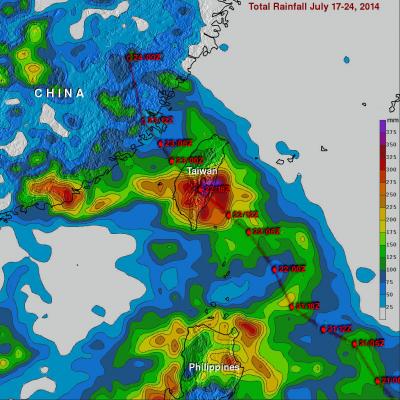
Iselle Moves Toward Hawaii
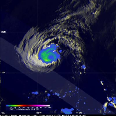
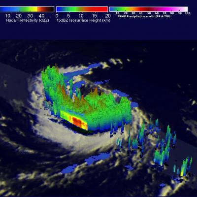
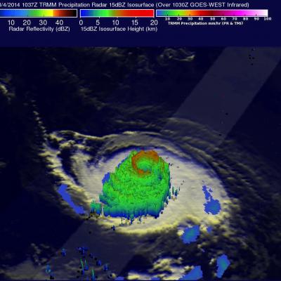
Hurricane Iselle has weakened from a very dangerous category four hurricane on August 4, 2014 to a category one hurricane when the TRMM satellite passed over on August 6, 2014 at 1020 UTC. Rainfall data from TRMM's Microwave Imager (TMI) and Precipitation Radar (PR) are shown overlaid on an enhanced infrared image from the 1000 UTC GOES-WEST satellite. TRMM TMI showed that heavy rainfall was occurring around the filling eye. TRMM TMI indicated that the most intense rain was falling at a rate of over 43.5 mm (about 1.7 inches) in a band southwest of the eye. The second image is an animation