California

California's Drought Improving

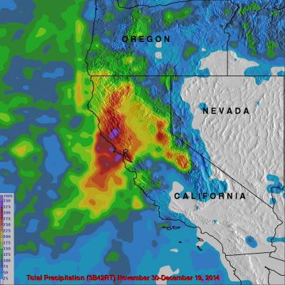
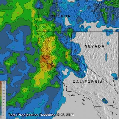
Waves of rainfall from Pacific Ocean storms show signs of improving the exceptional drought conditions that have been plaguing California. Starting on about November 30, 2014 storms frequently moved over California. A Multi-satellite Precipitation Analysis (MPA) using data (3B42) archived at near "real time" at the NASA Goddard Space Flight Center was used in the analysis. It indicates that northern California has had far more beneficial rainfall than southern California. This analysis shows that storms dropped over 350mm (almost 14 inches) in an area north of San Francisco. Southern

"Pineapple Express" Brings Heavy Rains, Flooding to U.S. West Coast

The West Coast, which has been suffering from a strong drought, is finally seeing some much needed relief as a steady stream of storms and rain pour into the coast from the Pacific. The rains began in Washington and Oregon and have now worked their way down the coast to southern California. The weather pattern responsible for all of the rain is known as the "Pineapple Express." The Pineapple Express is known as an atmospheric river. A large, slow-moving low pressure center off of the West Coast taps into tropical moisture originating around the Hawaiian Islands, which is then channeled

California's Rainfall Analyzed From Space

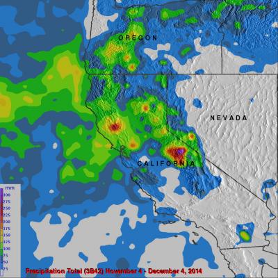
It has been very dry in the state of California for the past couple years. The lack of rain in 2013 and 2014 contributed to exceptional drought conditions in the state. Records were set over the past winter for the lowest winter snow packs recorded in a century. Rainfall produced by storms moving into California from the Pacific Ocean has recently brought some very temporary drought relief. Precipitation data (3B42) from various satellites such as TRMM and recently the GPM core observatory satellite have been collected, merged and archived at the Goddard Space Flight Center since 1998. The

Hurricane Odile Rainfall Totals

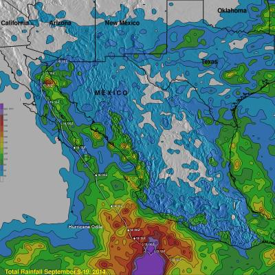
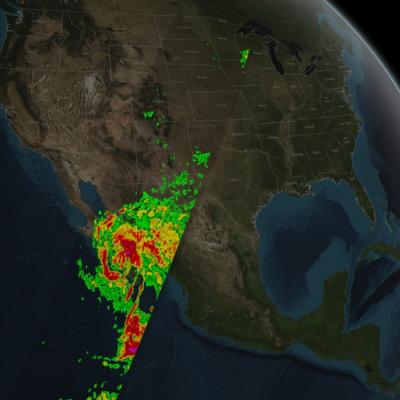
During the past week hurricane Odile and remnants have produced heavy rainfall that caused dangerous flooding over the Baja California peninsula and the southwestern United States. Rainfall from Odile may be welcomed in the Southwest where some areas have been experiencing extreme to exceptional drought conditions. The Tropical Rainfall Measuring Mission or TRMM satellite was launched in November 1997 with the primary mission of measuring rainfall in the Tropics using a combination of passive microwave and active radar sensors. The rainfall analysis above was made using real-time TRMM Multi
GPM Captures Hurricane Odile
​ ​ Animation revealing a swath of GPM/GMI precipitation rates over Hurricane Odile. The camera then moves down closer to the Hurricane to reveal DPR's volumetric view of Odile. As the camera rotates around the Hurricane, a slicing plane dissects Odile revealing it's inner precipitation rates closer to the eye. Shades of blue indicate frozen precipitation (in the upper atmosphere). Shades of green to red are liquid precipitation which extend down to the ground. On September 15, 2014 (15:11 UTC) the Global Precipitation Measurement (GPM) mission's Core Observatory flew over Hurricane Odile as...

Baja California Battered And Drenched By Odile

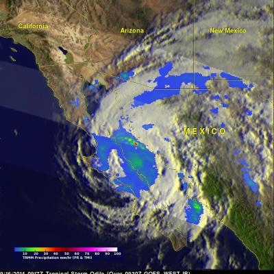
Category three hurricane Odile caused widespread destruction after hitting Baja California on Sunday night. Odile had weakened to a tropical storm with winds of about 55 kts ( 63.3 mph) when the TRMM satellite flew over on September 16, 2014 at 0917 UTC (2:19 AM PDT). Odile was still well organized and TRMM's Precipitation Radar (PR) measured rain falling at a rate of almost 130 mm (5.1 inches) per hour northeast of the tropical storms's center of circulation. The tops of some strong thunderstorms over the Gulf Of California were reaching heights of 13km (8 miles) and returning radar

Hurricane Odile Strikes Baja California

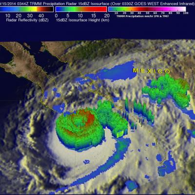
The TRMM satellite passed directly above hurricane Odile on September 15, 2014 at 0344 UTC. This was about an hour before the strong Hurricane hit Baja California near Cabo San Lucas at around 0445 UTC (September 14, 2014 9:45 PM PDT). The National Hurricane Center (NHC) hurricane discussion on September 15, 2014 said, "The estimated intensity of 110 kt at landfall ties Odile with Olivia (1967) as the strongest hurricane to make landfall in the satellite era in the state of Baja California Sur". The image above shows rainfall derived from TRMM's Precipitation Radar (PR) and Microwave Imager

TRMM Observes Storm Moving From California Eastward

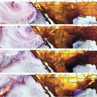
Images are routinely produced using TRMM Microwave Imager (TMI) data which show the global area covered by the satellite. These "Quick Look" images use Microwave brightness temperatures at 85.5 GHZ and at 37.0 GHZ combined in the red, green and blue components (guns) of the images. These false color images can be used to distinguish land from water and show the differences between land surfaces such as deserts, snow cover and sea ice. On these images areas of dry atmosphere over water appear as blue and moist atmosphere is dark blue. Snow cover over land appears as white or grey, deserts are