Mexico

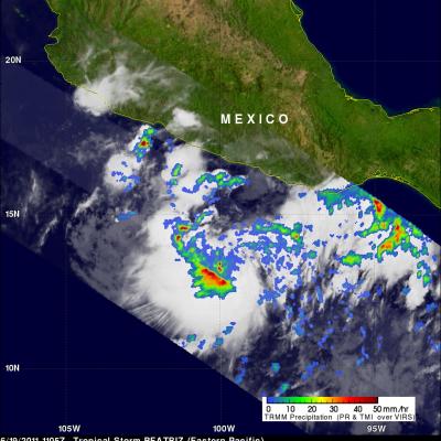
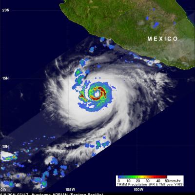
TRMM Sees Tropical Depression Forming JacobAdmin Thu, 07/07/2011
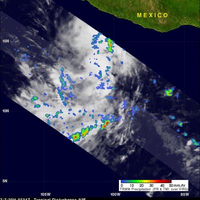
The TRMM satellite passed over an area of low pressure in the eastern Pacific Ocean south of Mexico on 7 July 2011 at 0234 UTC. The National Hurricane Center (NHC) in Miami, Florida upgraded this area of low pressure to a tropical depression at 1500 UTC ( 08:00 AM PDT) making it the third tropical depression in the eastern Pacific this hurricane season. Conditions are expected to be favorable for the depression to become a tropical storm within the next couple days. The rainfall analysis from TRMM's Microwave Imager (TMI) and Precipitation Radar (PR) data was overlaid on an infrared image from

Arlene Brings Heavy Rains to Mexico

Arlene formed into a tropical storm on the evening of 28 June 2011 in the Bay of Campeche in the southwestern Gulf of Mexico from an area of low pressure that had formed the day before just west of the Yucatan Peninsula. Arlene did not have time to fully develop and came ashore as a strong tropical storm two days later on the morning of 30 June near Cabo Rojo along Mexico's east coast with sustained winds reported at 65 mph. Although wind damage from the storm was relatively minor, Arlene brings the threat of heavy rains and flash flooding to the region as it continues to move inland. The

Arlene Is First 2011 Atlantic Tropical Storm

The National Hurricane Center (NHC) named Tropical Storm Arlene the first tropical storm of the 2011 Atlantic hurricane season on 29 June 2011 at 0000 UTC (7 PM CDT). The TRMM satellite had a good look at Arlene when it passed above on 29 June 2011 at 0502 UTC (0:02 AM CDT). At that time Arlene's winds were estimated to be about 34 knots (~39 mph) indicating that it was barely a tropical storm. TRMM's Microwave Imager (TMI) and Precipitation Radar (PR) data were used in the analysis on the upper left and show that Arlene was getting better organized and contained scattered heavy thunderstorms

TRMM Sees Arlene Threatening Mexico

The TRMM satellite again flew over tropical storm Arlene on 30 June 2011 at 0408 UTC before the first tropical storm of the Atlantic hurricane season came ashore in Mexico. Arlene had become a strong tropical storm with sustained winds of about 55 kts (~63 mph). The rainfall analysis above is from TRMM's Microwave Imager (TMI) and Precipitation Radar (PR). It shows that Arlene contained areas of very heavy rainfall. A few rain showers from Arlene were starting to reach Mexico and extreme southern Texas but at that time the most intense storms were still located in the Gulf Of Mexico east of

TRMM Monitors Southern Mexico's Rainfall

The TRMM satellite flew over an area of disturbed weather labeled 95L affecting southern Mexico on 27 June 2011 at 2148 UTC (5:48 PM EDT). The TRMM rainfall analysis shown above used TRMM's Microwave Imager (TMI) and Precipitation Radar (PR) data. It shows that heavy rainfall of over 50mm (~2 inches) associated with 95L was occurring in southern Mexico northwest of Veracruz and over the Yucatan Peninsula. Some of this very heavy rainfall may result in flash flooding and mudslides. The National Hurricane Center (NHC) is watching this area and has indicated that there is a slight chance that a

Tropical Storm BEATRIZ Forms Off Mexican Coast

Tropical depression 02E was upgraded to tropical storm Beatriz on 19 June 2011 at 1800 UTC (1100 AM PDT). The TRMM satellite flew over on the same date at 1105 UTC( 0400 AM PDT) obtaining data used in the image shown above. Beatriz was already well organized with TRMM's Microwave Imager (TMI) and Precipitation Radar (PR) data showing that thunderstorms were dropping heavy rainfall in a large area near the center of the forming storm. PR data revealed that some of these powerful storms were reaching heights above 15 km (9.3 miles).

Adrian now a Powerful Hurricane

The TRMM satellite captured data used in this dramatic image of Hurricane Adrian when it passed directly above on 9 June 2011 at 0714 UTC. The increasingly powerful hurricane had sustained winds estimated to be close to 80 kts (~92 mph) at the time of this pass. TRMM's Precipitation Radar (PR) instrument revealed that beneath the clouds there were intense thunderstorms dropping rain at a rate of over 50 mm/hr (~2 inches) in a nearly circular eye wall. The PR also indicated that some thunderstorms in the eye wall were shooting up to heights above 15 km (~9.3 miles). Click here to see a