Tropical Storm in the Arabian Sea
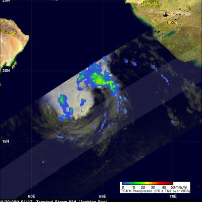
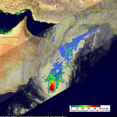
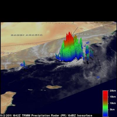
Tropical Storm 05A, the 5th of the season in the North Indian Ocean, has been steadily making it's way northwestward across the Arabian Sea over the past few days but is now expected to weaken, reducing the threat to Oman, southern Iran and Pakistan. The storm formed back on November 26th in the North Indian Ocean about 170 km (~105 miles) west of the southern tip of India and has maintained the same minimal tropical storm intensity with sustained winds of around 35 knots (~40 mph) while moving steadily to the northwest into the central Arabian Sea. The Tropical Rainfall Measuring Mission