PMM

Content which is not specifically affiliated with GPM or TRMM, but which is about the Precipitation Measurement Missions in general.

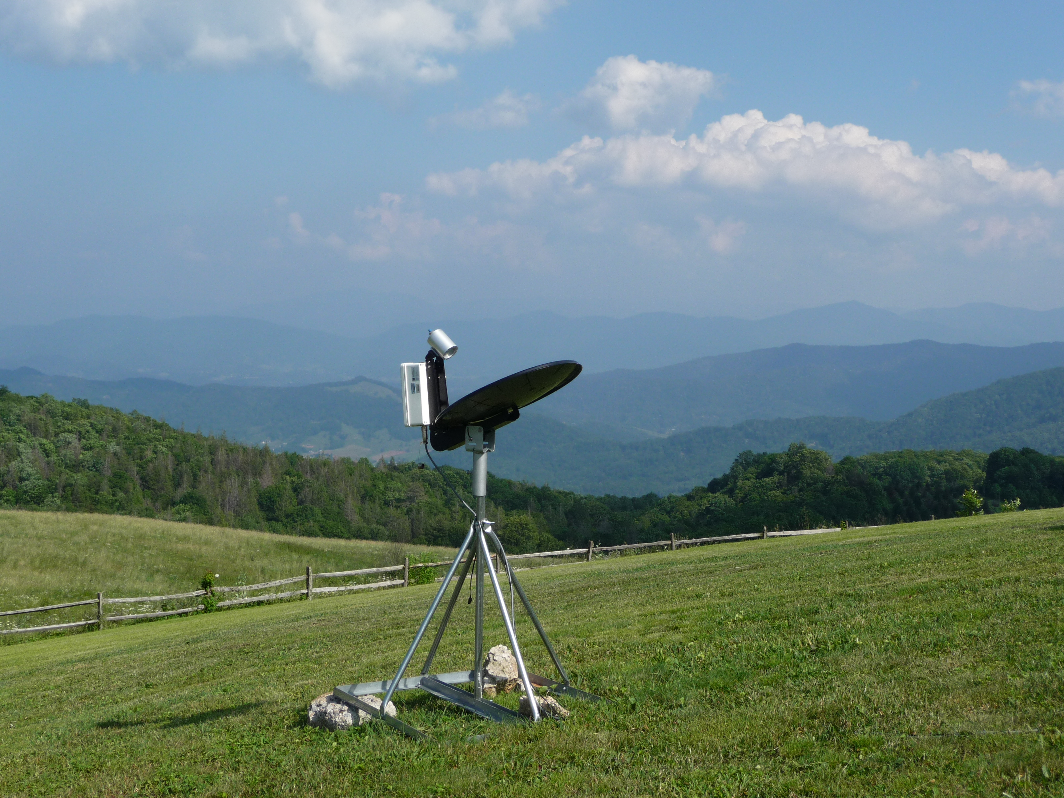
MicroRain Radar in the Smokies

MicroRain Radar in the Smokies
Image Caption
MicroRain Radar at Purchase Knob in the Great Smoky Mountains National Park.

This instrument is a vertical profiler radar that delivers information about structure in the atmospheric column and enables scientists to estimate the vertical distribution of rainfall. At all times of the day, light rainfall is the dominant type of precipitation. 

Light Rain in the Smokies

A misty mountaintop in the Smokies
Image Caption
Mid-morning peak in light rainfall appears as clouds and fog at Purchase Knob in the Great Smoky Mountains National Park.

Light rainfall is the most reliable and most frequent form of rainfall in the region, contributing 50 to 60 percent of the total precipitation over a year. Light rain is no less than the lifeline of freshwater resources for the landscape’s ecosystems. 

Document Description

This excerpt from the March-April 2012 edition of The Earth Observer provides a summary of the activities at the PMM Science Team Meeting which took place from November 7 - 10 2011. The meeting brought together over 150 participants from 10 countries, and included representatives from NASA, JAXA, the National Oceanic and Atmospheric Administration (NOAA), universities, industry, and other international partner agencies.

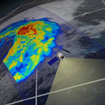
GPM flying over Earth with a data swath visualized.
Precipitation Measurement Mission Science NASA’s Precipitation Measurement Missions (PMM) develop and deploy advanced space-borne sensors to gain physical insights into precipitation processes and to enable improved monitoring and forecasting of climate, weather and precipitation-related natural hazards. PMM includes the Tropical Rainfall Measuring Mission (TRMM) and the Global Precipitation Measurement (GPM) mission. TRMM and GPM pursue a unique and innovative approach to measuring precipitation from space through the collection of observations by both active and passive sensors , which are...

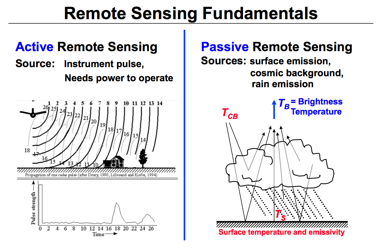
Active and Passive Remote Sensing Diagram

Diagram illustrating the differences between active and passive remote sensing.
Image Caption
This diagram illustrates the differences between active and passive remote sensing.

TRMM and GPM rely on active and passive instruments to measure the properties of precipitation from space.

Active radars, such as the TRMM Precipitation Radar, transmit and receive signals reflected back to the radar. The signal returned to the radar receiver (called radar reflectivity) provides a measure of the size and number of rain/snow drops at multiple vertical layers in the cloud (Left figure).

GPM flying over Earth with a data swath visualized.
In addition to the PMM satellites, TRMM and GPM, roughly a dozen other satellites carry precipitation-relevant sensors. The goal of multi-satellite algorithms is to use “all” of the available quasi-global precipitation estimates computed from this international constellation of satellites to create a High-Resolution Precipitation Product with complete coverage over the chosen domain and period of record (currently 50°N-50°S, 1998-present). Estimates based on microwave and combined radar/radiometer input data have higher quality due to the physically direct relationships that exist between...
GPM flying over Earth with a data swath visualized.
Precipitation radiometers provide additional degrees of freedom for interpreting rain and snow in clouds through the use of multiple passive frequencies (9 for TRMM and 13 for GPM). Brightness temperatures at each frequency are a measure of everything in their field of view. These frequencies from the low (10 GHz) end to the high (183 GHz) end transition from being sensitive to liquid rain drops to being sensitive to the snow and ice particles. So, simplifying, when there is liquid rain in the cloud column, the low frequency channels will respond; when there is snow the high frequency channels...
GPM flying over Earth with a data swath visualized.
The combined use of coincident active and passive microwave sensor data provides complementary information about the macro and microphysical processes of precipitating clouds which can be used to reduce uncertainties in combined radar/radiometer retrieval algorithms. In simple terms, the combined algorithms use the radiometer signal as a constraint on the attenuation seen by the radar. The combined retrievals produce a hydrometeor profile, particle size distribution and surface parameters for which brightness temperatures and reflectivities are consistent with the actual satellite measurements...
GPM flying over Earth with a data swath visualized.
The unique function of precipitation radars is to provide the three-dimensional structure of rainfall, obtaining high quality rainfall estimates over ocean and land. Radar measurements are typically less sensitive to the surface and provide a nearly direct relationship between radar reflectivities and the physical characteristics of the rain and snow in a cloud. Because of the complexities of operating radar in space, limited channels (frequencies) are designed for the instruments. TRMM has a single frequency radar at the Ku-band particularly sensitive to moderate rain rates. With a single...