TD11 Upgraded To Tropical Storm Jerry

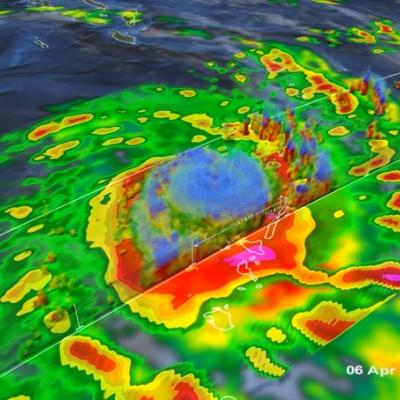
At 1500 UTC (11:00 AM EDT) the National Hurricane Center (NHC) upgraded TD11 to tropical storm Jerry. Tropical Depression ELEVEN (TD11) developed in the central Atlantic Ocean on Saturday September 28, 2013. Southwesterly wind shear reduced TD11's strengthening until this morning. TD11 was having strong bursts of convection when the TRMM satellite flew over earlier at 0929 UTC (~ 6:29 AM Local Time). The image on the left shows a rainfall analysis that uses TRMM Precipitation Radar (PR) data from that orbit. It shows that rain was falling at a rate of over 150 mm/hr from some powerful

Western India's Intense Monsoon Rain

Western India has been having intense monsoon rainfall since September 21, 2013. This has resulted in widespread flooding in the west Indian state of Gujarat and reports of at least three related deaths. India had record breaking flooding in the northern state of Uttarakhand in June 2013 with more than 6,000 people killed. Near real-time TRMM Merged HQ/Infrared Precipitation (3B42) data were used in the rainfall analysis above. Rainfall total estimates from these space satellite data for the seven day period from September 20-27, 2013 were used. The highest totals of almost 800mm (~31.5 inches

Deadly Typhoon Usagi Hits Southern China

The most powerful typhoon of 2013 hit southern China with reported winds of 95.6 kts (~110 mph) killing at least 20 people. The TRMM satellite had a fairly good view on September 22, 2013 at 0923 UTC as typhoon USAGI's eye was very near the coast of southern China. TRMM's Microwave Imager (TMI) and Precipitation Radar (PR) instruments showed that in addition to the extreme winds reported there were areas just south of USAGI's eye where rain was falling at a rate of over 169mm/hr (~6.7 inches). TRMM sliced through USAGI and found that heights of storms within USAGI were reaching only about 12km

Mexico Flooded by Tropical Storm Manuel and Hurricane Ingrid

Mexico's Pacific and Gulf coasts were both inundated by deadly tropical rainfall at the same time. Hurricane Manuel dropped extremely heavy rainfall along Mexico's Pacific coast. At least 55 people have been reported killed in Mexico due to flooding and landslides caused by extreme rainfall. Hurricane Ingrid weakened to a tropical storm and came ashore from the Gulf Of Mexico into the state of Tamaulipas near La Pesca, Mexico on Monday September 16,2013. The approximate 0000Z and 1200Z locations of the tropical cyclones are shown overlaid in white. The TRMM-based, near-real time Multi-

Typhoon Usagi Still Powerful

The TRMM satellite again flew directly above category two typhoon USAGI, with maximum wind speeds of about 120kts (~130mph), on September 21, 2013 at 0209 UTC as USAGI was passing between Taiwan and the Philippines. Rainfall data from TRMM's Microwave Imager (TMI) and Precipitation Radar (PR) instruments are shown in this image. TRMM PR found rain falling at a rate of over 134 mm/hr (~5.2 inches) in USAGI's eye wall where radar reflectivity values of over 51dBZ were returned to the satellite. A weaker Typhoon USAGI is predicted to hit Hong Kong tomorrow with wind speeds of 80kts (~92 mph).