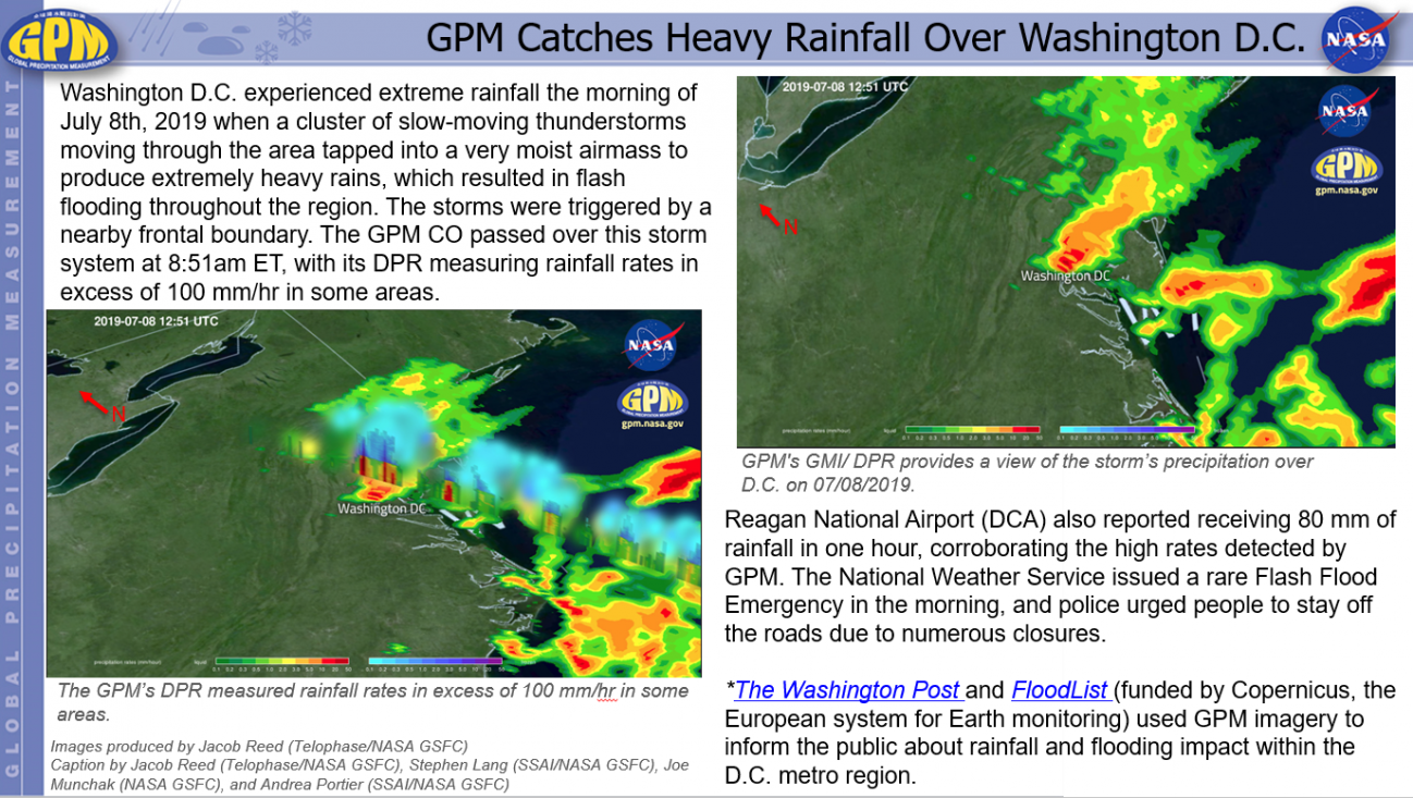
GPM Catches Heavy Rainfall Over Washington D.C. Monday, July 8, 2019 Download Highlight GPMHighlights_RainfallDC_070819.pptx1.41 MB
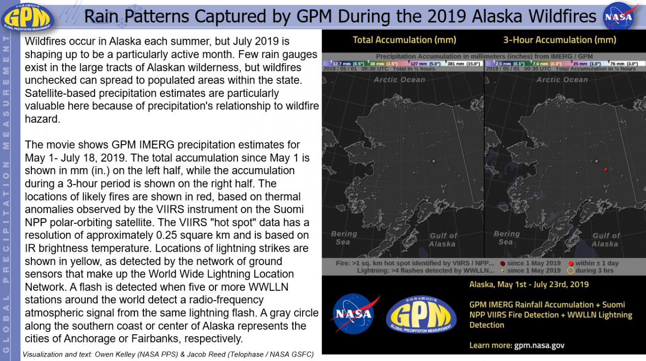
Rain Patterns Captured by GPM During the 2019 Alaska Wildfires Friday, July 26, 2019 Download Highlight GPMHighlights_AlaskaFires_190726.pptx58.32 MB
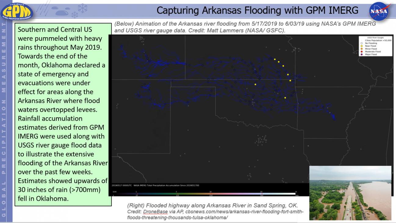
Capturing Arkansas Flooding with GPM IMERG Tuesday, June 4, 2019 Download Highlight GPMHighlights_ArkansasRiverFlooding_190604.pptx13.52 MB
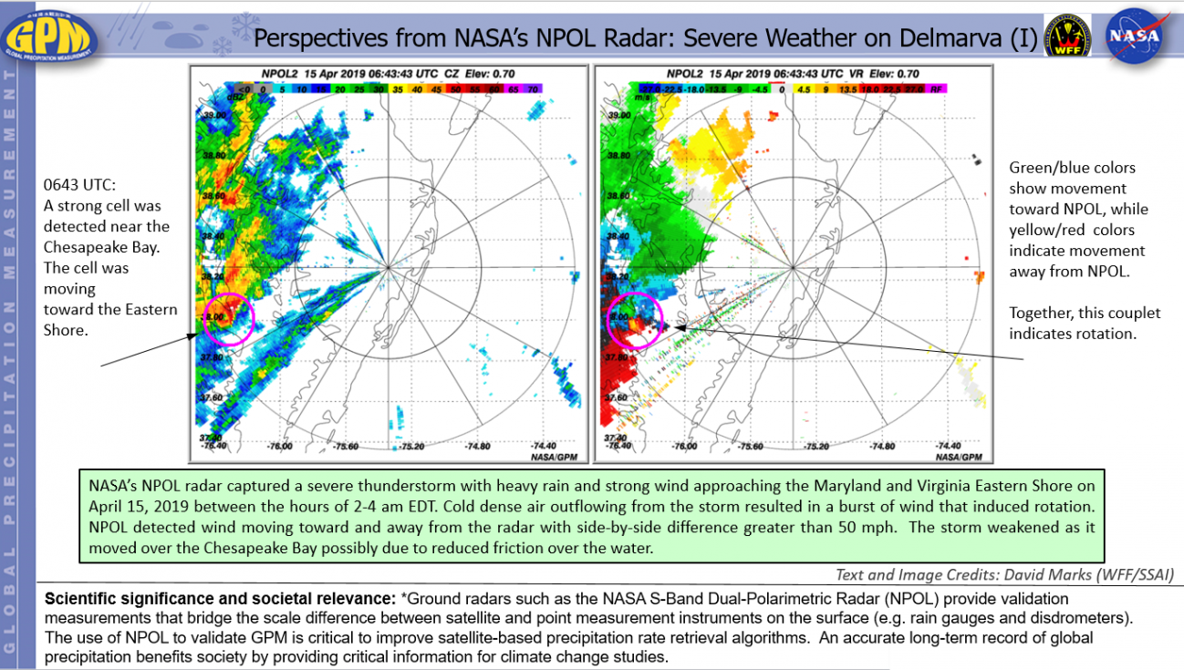
Perspectives from NASA’s NPOL Radar: Severe Weather on Delmarva Monday, April 15, 2019 Download Highlight GPMHighlights_NPOL_190415.pptx6.37 MB
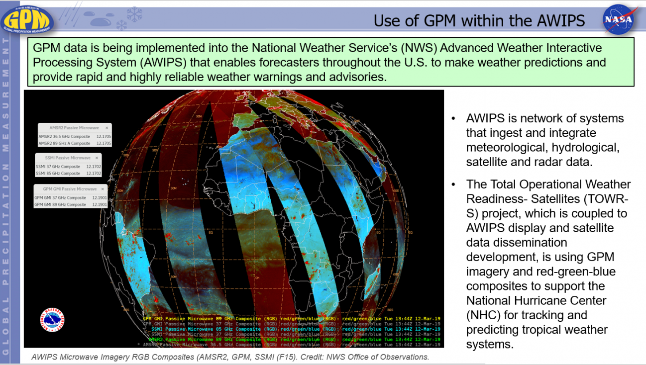
Use of GPM within the AWIPS Friday, May 24, 2019 Download Highlight GPMHighlights_5_24_2019_NWS_AWIPS.pptx2.21 MB