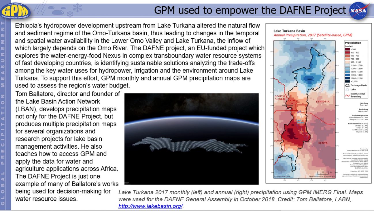
GPM used to empower the DAFNE Project Thursday, April 18, 2019 Download Highlight GPMHighlights4_18_2019_LakeTurkana.pptx1.33 MB
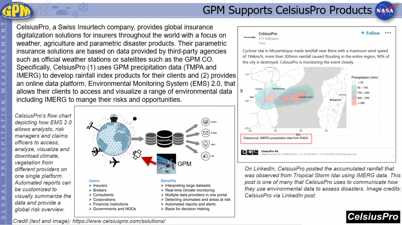
GPM Supports CelsiusPro Products Thursday, April 18, 2019 Download Highlight GPMHighlights4_18_2019_CelsiusProsolutions_0.pptx673.51 KB
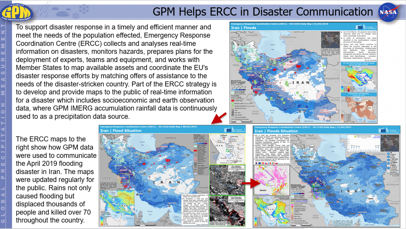
GPM Helps ERCC in Disaster Communication Monday, April 8, 2019 Download Highlight GPMHighlights4_8_2019IranRain.pptx1.42 MB
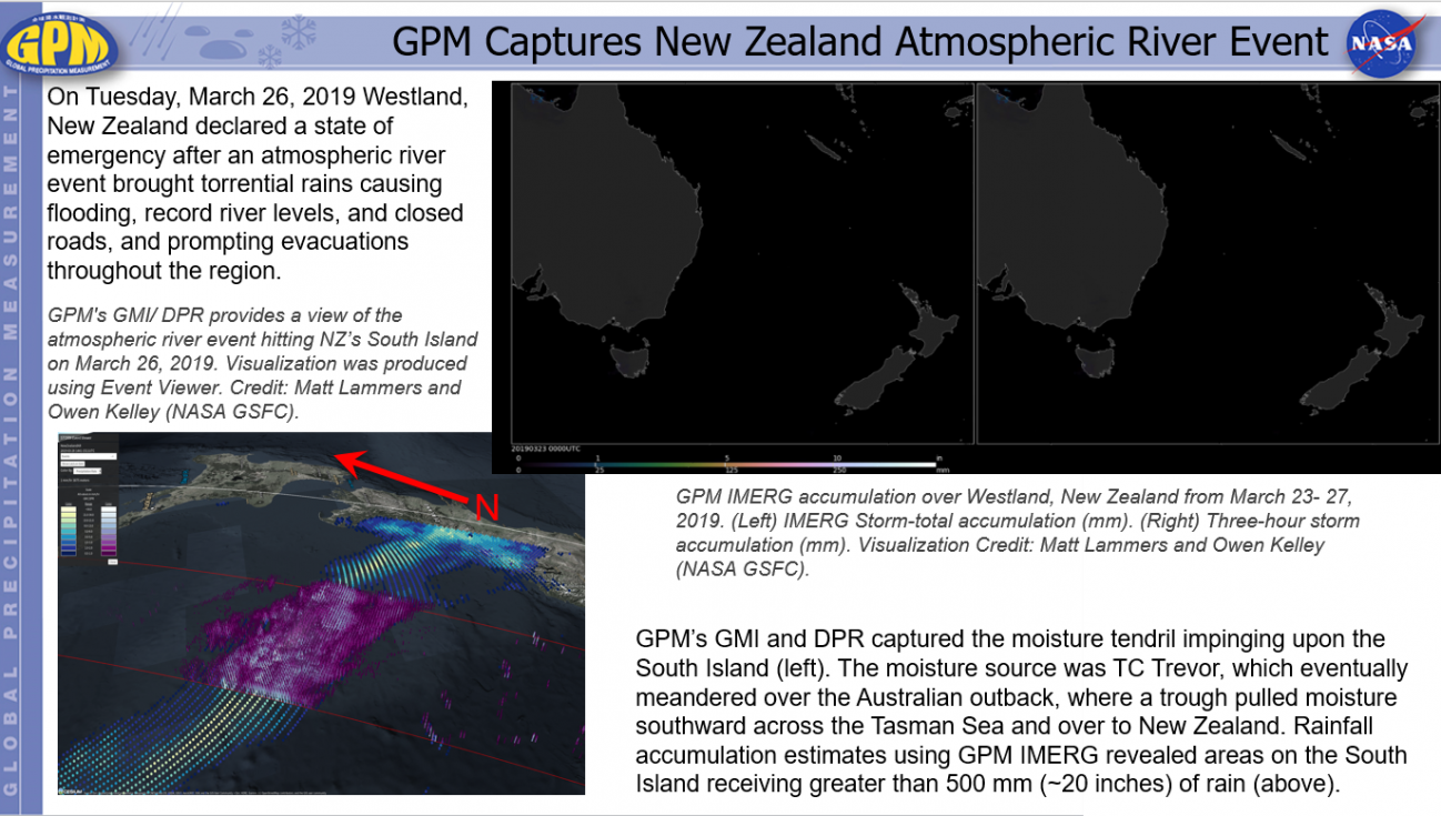
GPM Captures New Zealand Atmospheric River Event Thursday, March 28, 2019 Download Highlight GPMHighlights3_28_2019AR New Zealand.pptx6.12 MB
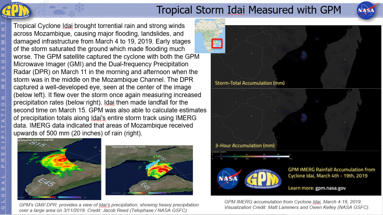
Tropical Storm Idai Measured with GPM Friday, March 22, 2019 Download Highlight GPMHighlights3_22_2019TSIdai.pptx27.63 MB