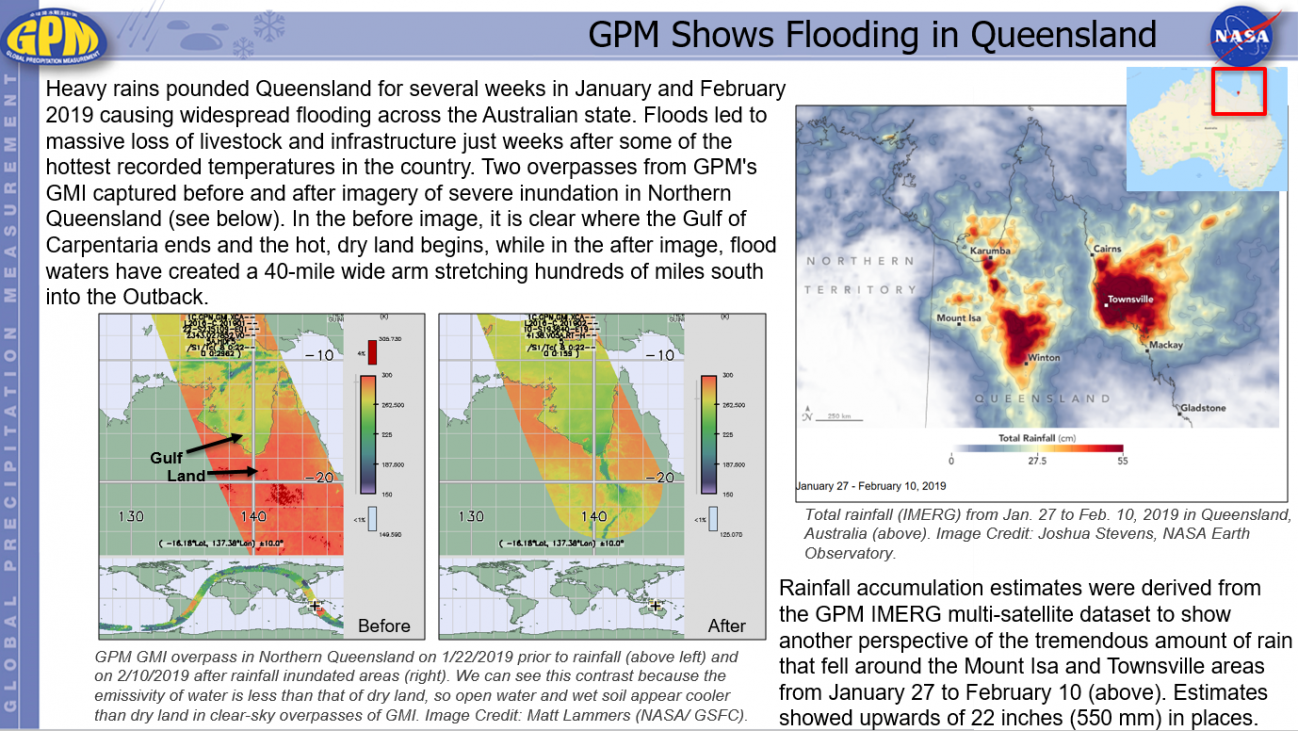
GPM Shows Flooding in Queensland Friday, February 15, 2019 Download Highlight GPMHighlights2_15_2019QueenslandFlooding.pptx1.28 MB
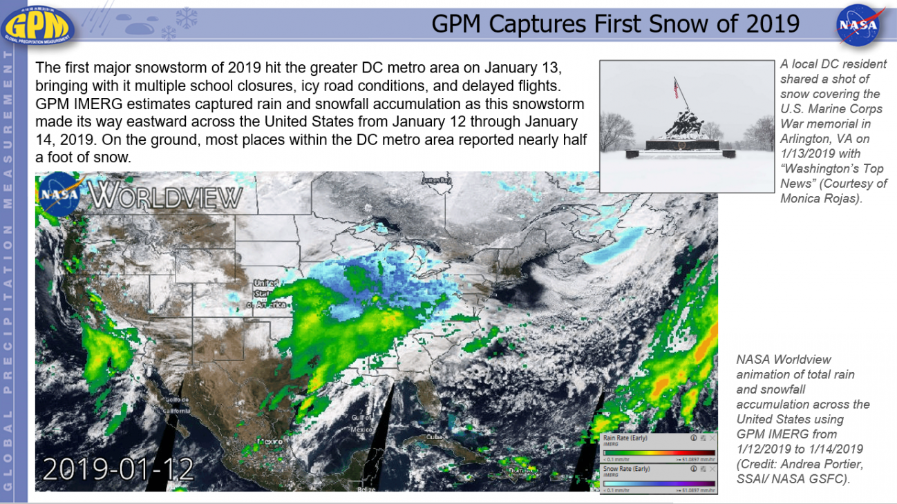
GPM Captures First Snow of 2019 Tuesday, January 29, 2019 Download Highlight GPMHighlights1_29_2019FirstSnowStormofYear.pptx1.35 MB
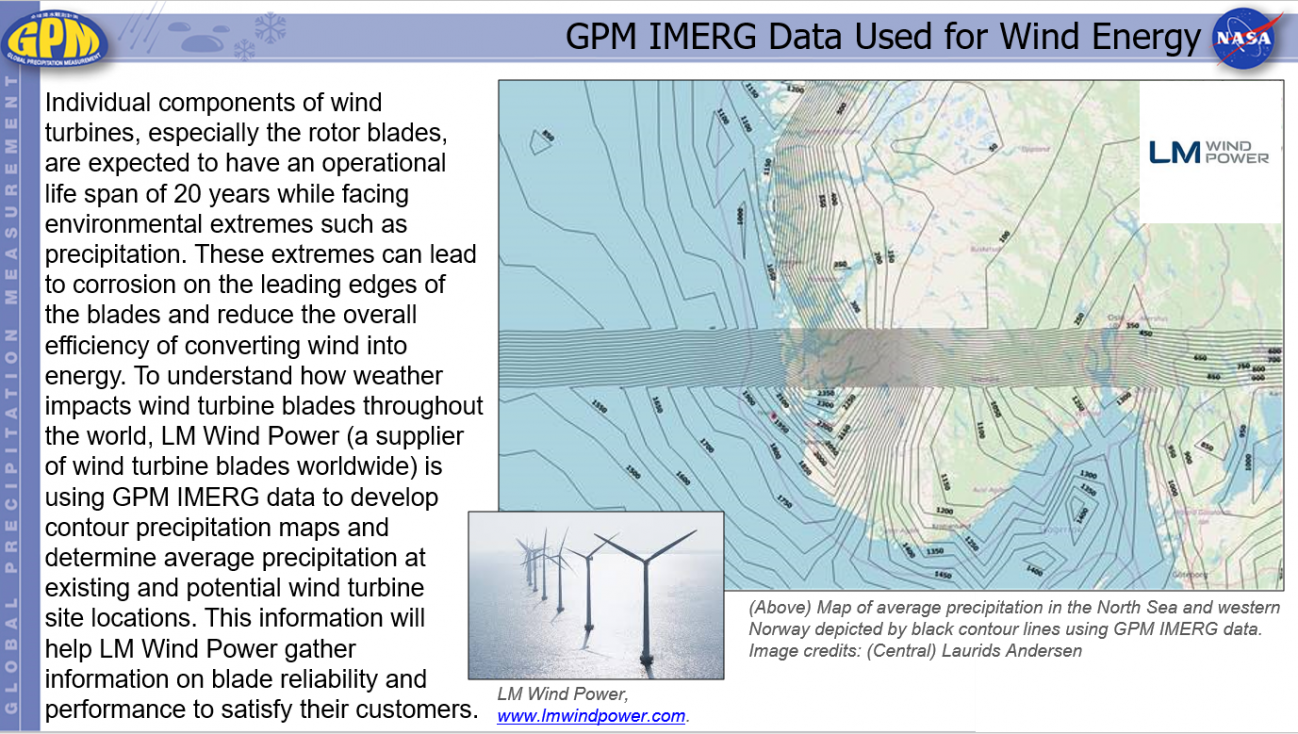
GPM IMERG Data Used for Wind Energy Monday, February 4, 2019 Download Highlight GPMHighlights1_28_2019_LM Wind Power.pptx588.42 KB
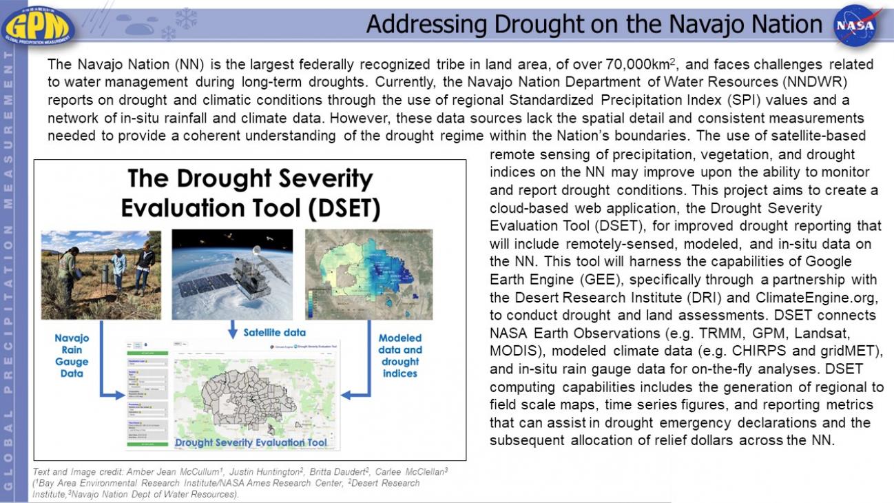
Addressing Drought on the Navajo Nation Friday, August 23, 2019 Download Highlight GPMHighlight_NavajoNation_08232019.pptx702.63 KB