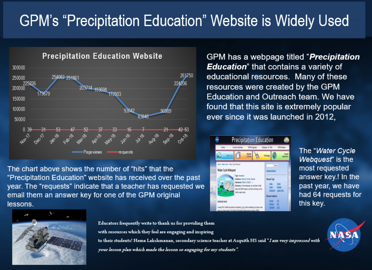
GPM’s “Precipitation Education” Website is Widely Used Thursday, November 8, 2018 Download Highlight 8Nov2018Precipitation Education.pptx3.59 MB
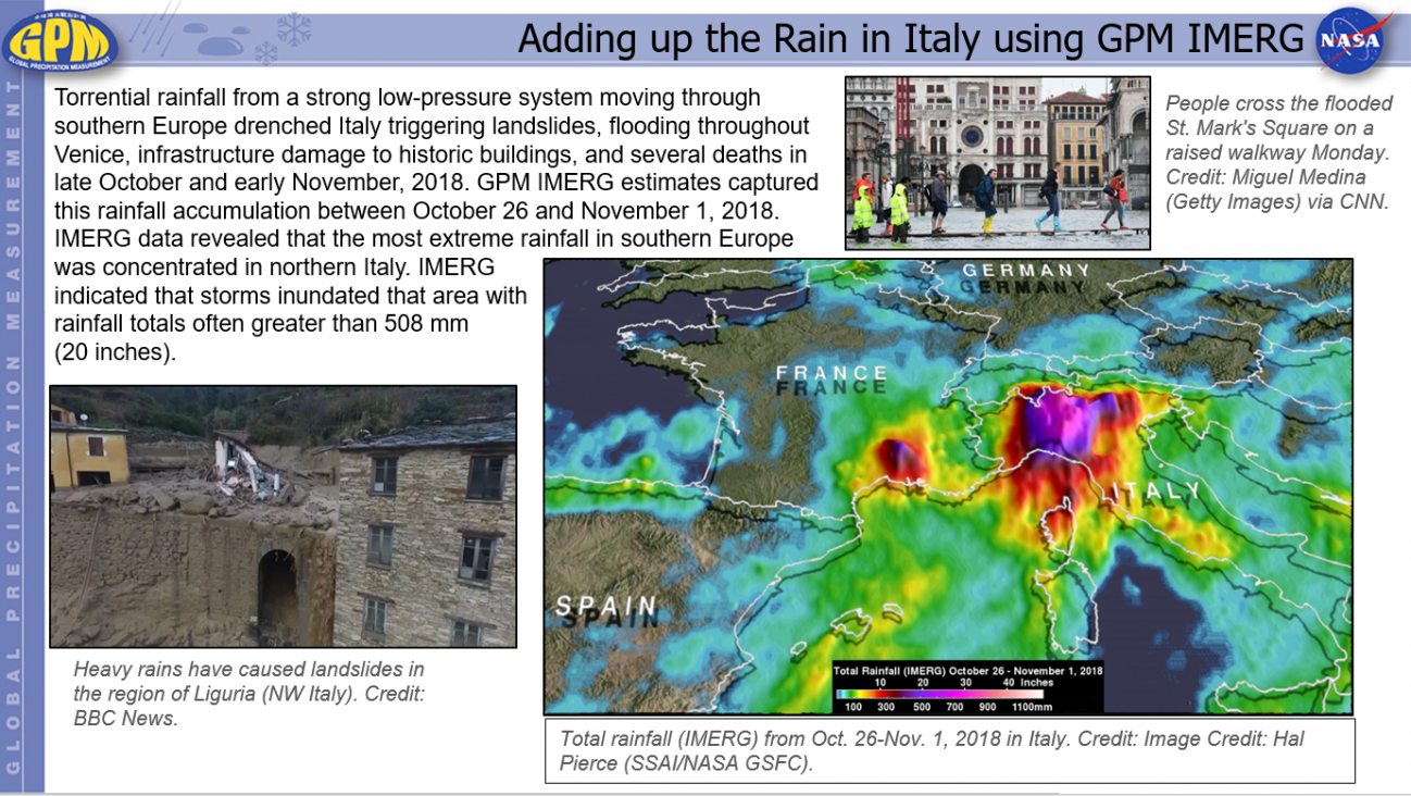
Adding up the Rain in Italy using GPM IMERG Wednesday, November 7, 2018 Download Highlight GPMHighlights11_07_2018_Italy_rain.pptx1.83 MB
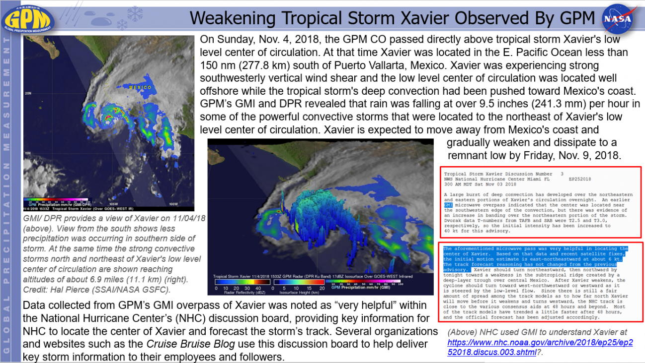
Weakening Tropical Storm Xavier Observed By GPM Thursday, November 8, 2018 Download Highlight GPMHighlights11_08_2018TS Xavier.pptx1.04 MB
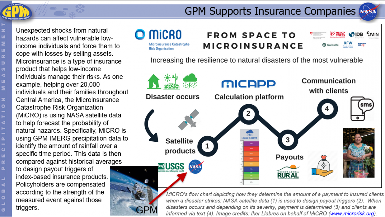
GPM Supports Insurance Companies Friday, November 30, 2018 Download Highlight GPMHighlights11_30_2018_Reinsurance.pptx1.28 MB
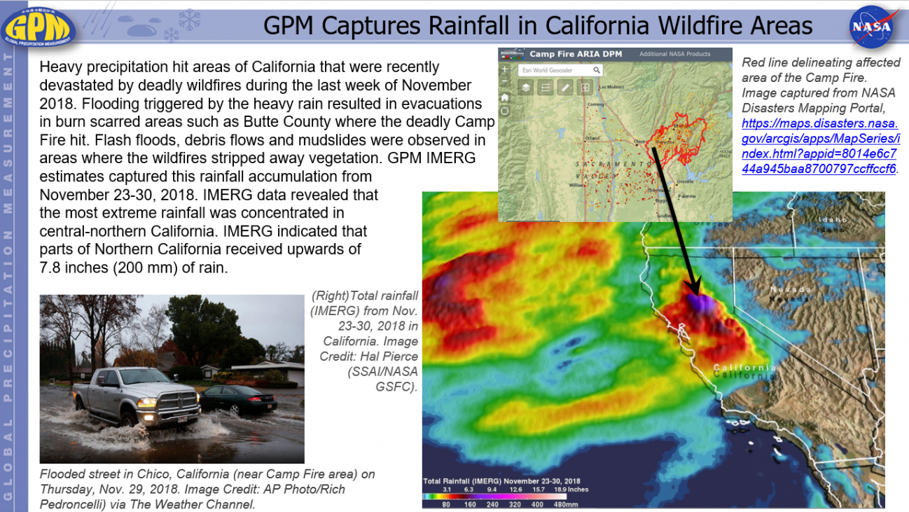
GPM Captures Rainfall in California Wildfire Areas Wednesday, December 5, 2018 Download Highlight GPMHighlights12_05_2018RainNorthCalifornia.pptx2.24 MB