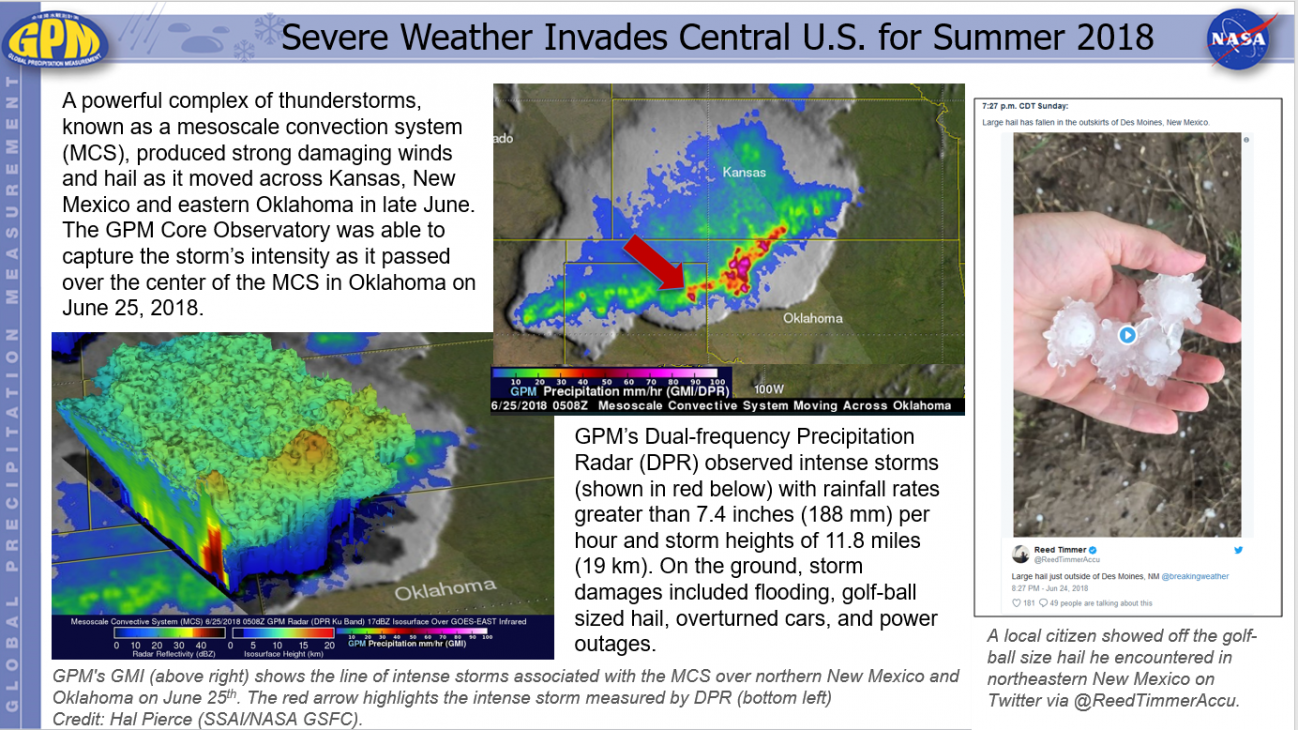
Severe Weather Invades Central U.S. for Summer 2018 Friday, June 29, 2018 Download Highlight GPMHighlights6_29_2018CentralUSWeather.pptx1.03 MB
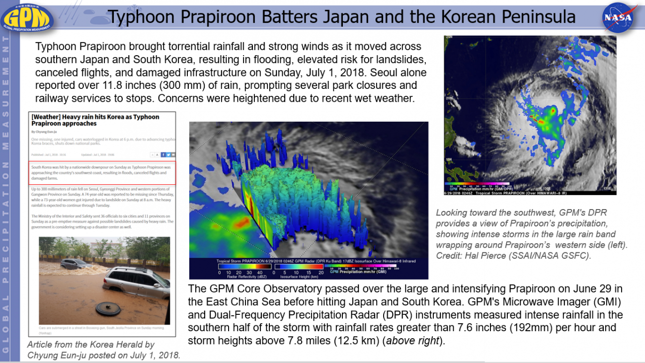
Typhoon Prapiroon Batters Japan and the Korean Peninsula Thursday, July 5, 2018 Download Highlight GPMHighlights7_5_2018TyphoonPrapiroon.pptx1.39 MB
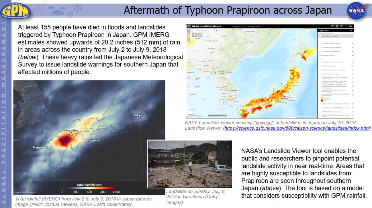
Aftermath of Typhoon Prapiroon across Japan Tuesday, July 10, 2018 Download Highlight GPMHighlights7_10_2018PrapiroonLandslides.pptx2.14 MB
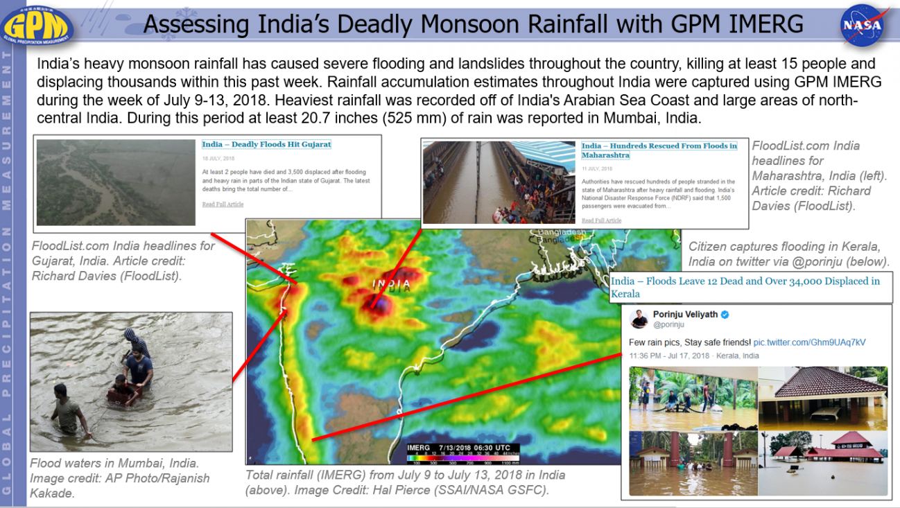
Assessing India’s Deadly Monsoon Rainfall with GPM IMERG Thursday, July 19, 2018 Download Highlight GPMHighlights7_19_2018IndiaMonsoon.pptx1.33 MB
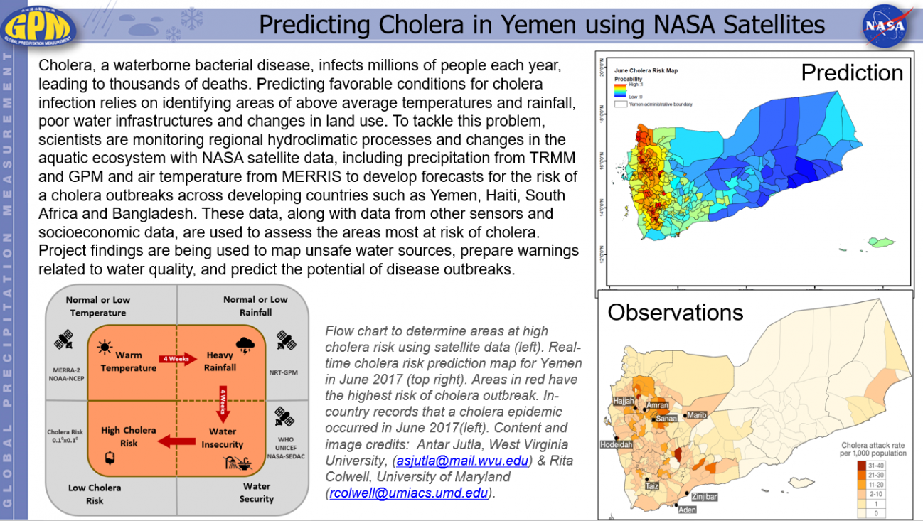
Predicting Cholera in Yemen using NASA Satellites Thursday, July 19, 2018 Download Highlight GPMHighlights7_19_2018PredictingCholera.pptx633.47 KB