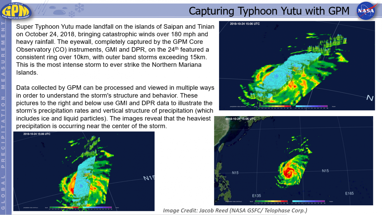
Capturing Typhoon Yutu with GPM Thursday, October 25, 2018 Download Highlight TyphoonYutuhighlights.pptx25.46 MB
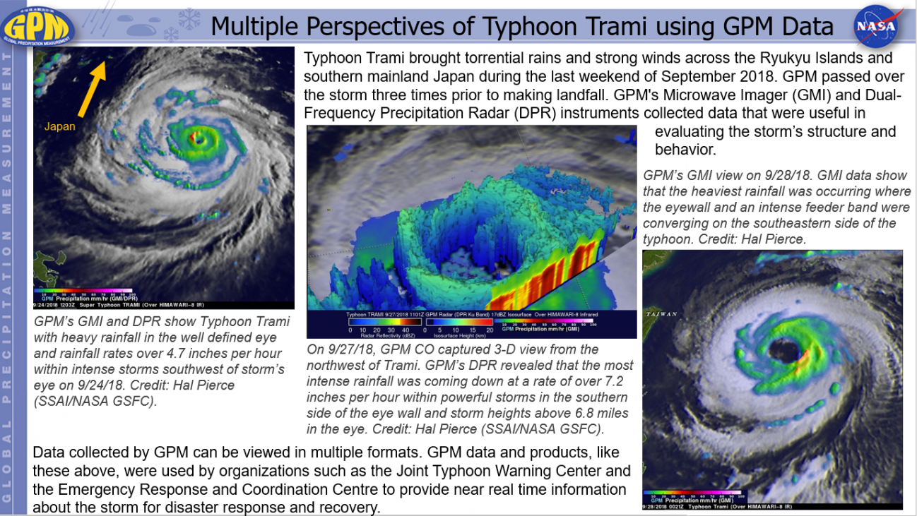
Multiple Perspectives of Typhoon Trami using GPM Data Tuesday, September 25, 2018 Download Highlight TyphoonTramiHighlights.pptx40.08 MB
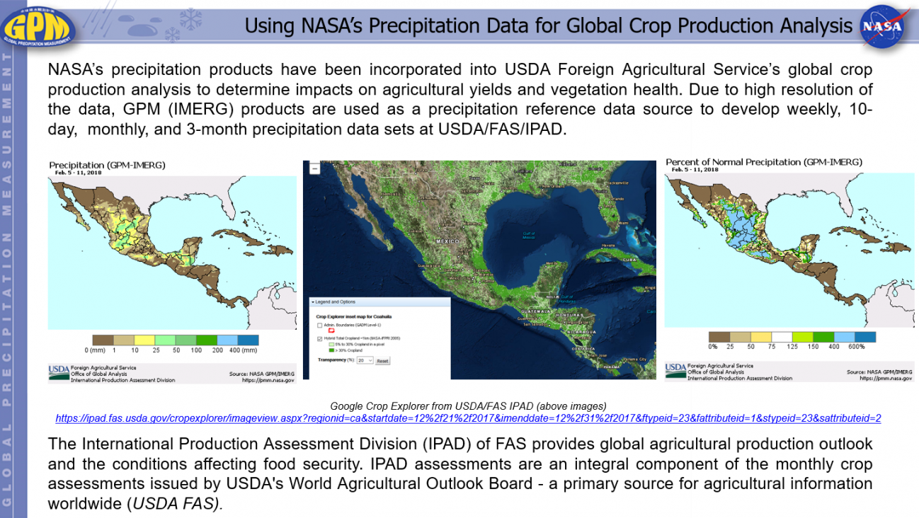
Using NASA’s Precipitation Data for Global Crop Production Analysis Thursday, June 7, 2018 Download Highlight GPMHighlight6_7_2018USDA.pptx1.13 MB
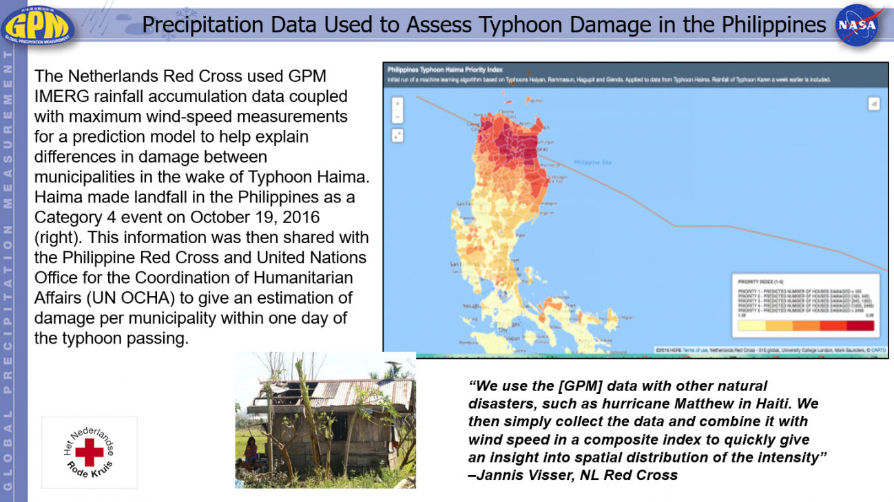
Precipitation Data Used to Assess Typhoon Damage in the Philippines Thursday, June 7, 2018 Download Highlight GPMHighlight6_7_2018RedCross.pptx487.13 KB
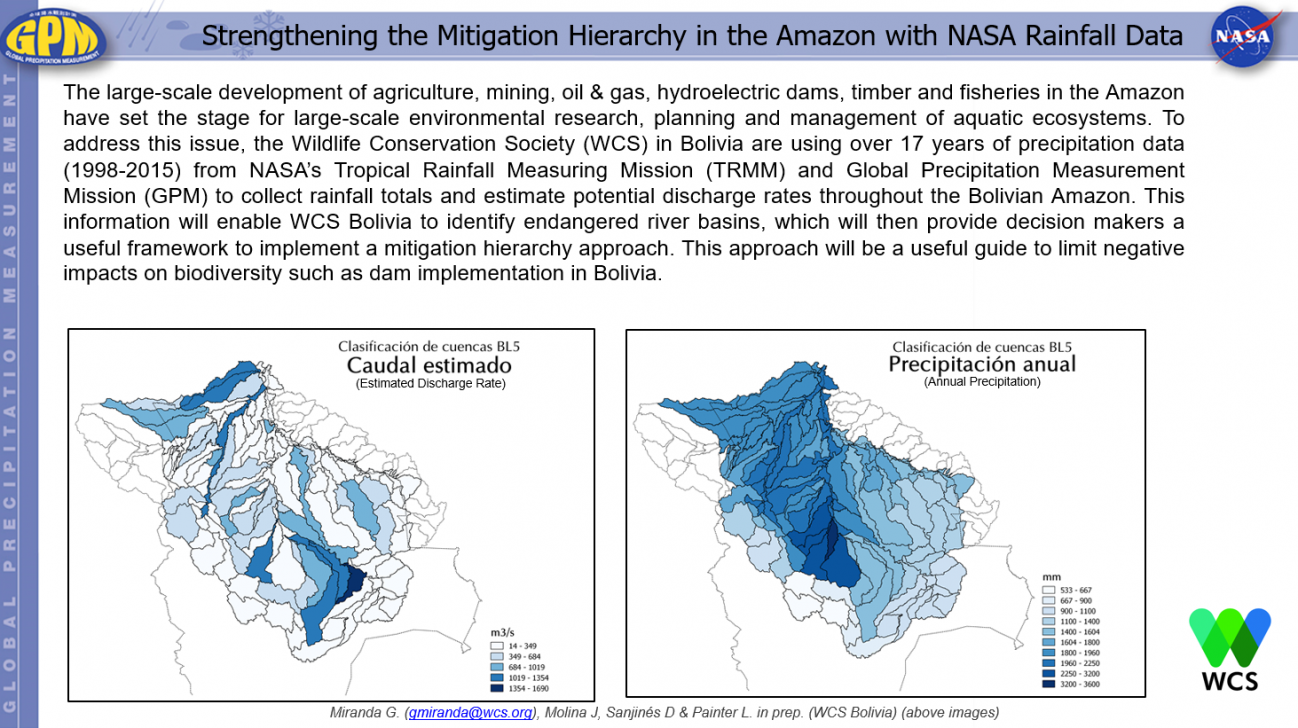
Strengthening the Mitigation Hierarchy in the Amazon with NASA Rainfall Data Thursday, June 7, 2018 Download Highlight GPMHighlight6_7_2018Amazon.pptx440.96 KB