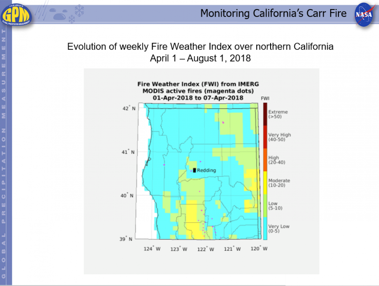
Monitoring California’s Carr Fire Friday, August 3, 2018 Download Highlight GPMHIghlight_8_3_2018CarrFireAnimation.pptx6.36 MB
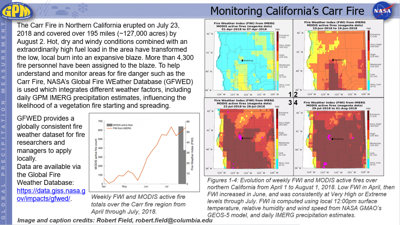
Monitoring California’s Carr Fire Friday, August 3, 2018 Download Highlight GPMHighlights8_3_2018CarrFire.pptx886.83 KB
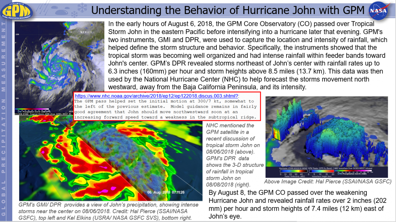
Understanding the Behavior of Hurricane John with GPM Thursday, August 9, 2018 Download Highlight GPMHighlights8_09_2018HurricaneJohn.pptx1.61 MB
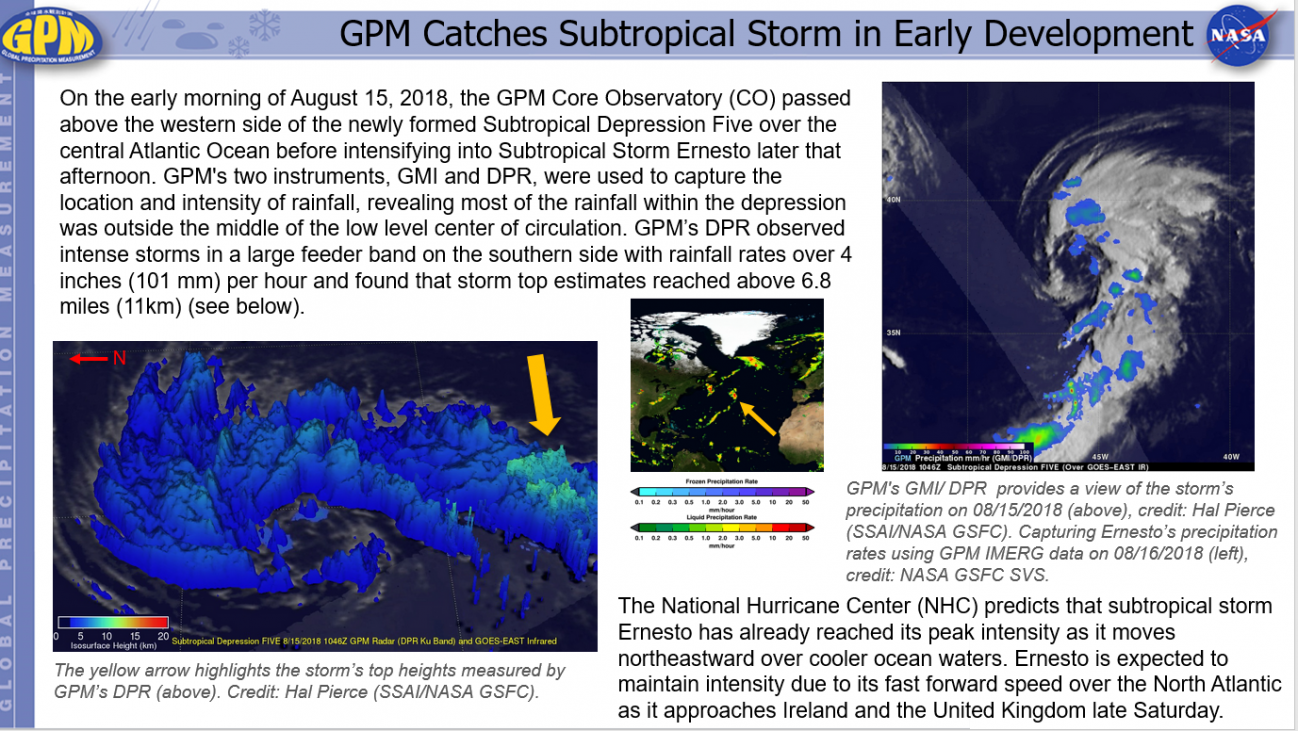
GPM Catches Subtropical Storm in Early Development Thursday, August 16, 2018 Download Highlight GPMHighlights8_16_2018SubtropicalDepressionFive.pptx1.3 MB
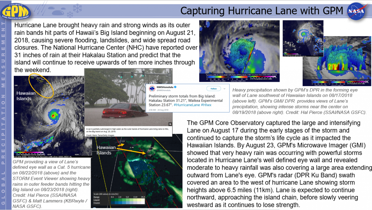
Capturing Hurricane Lane with GPM Friday, August 24, 2018 Download Highlight GPMHighlights8_24_2018HurricaneLane.pptx1.56 MB