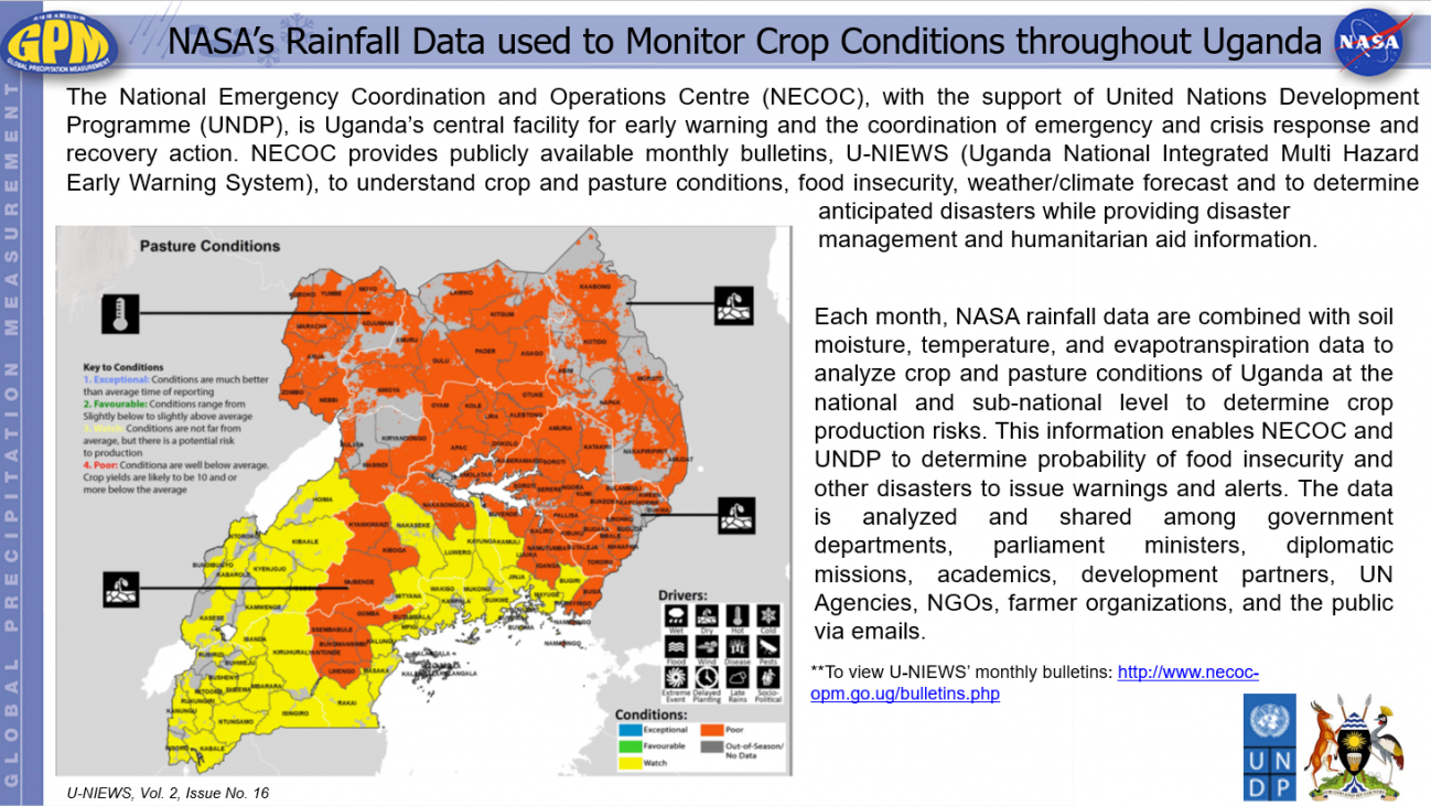
NASA’s Rainfall Data used to Monitor Crop Conditions throughout Uganda Thursday, June 7, 2018 Download Highlight GPMHighlight6_7_2018Uganda.pptx3.71 MB
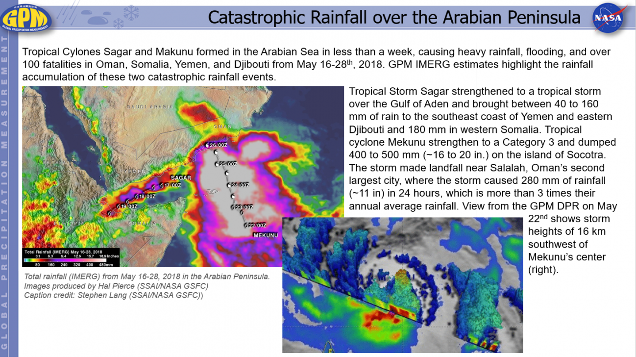
Catastrophic Rainfall over the Arabian Peninsula Thursday, June 7, 2018 Download Highlight GPMHighlight6_7_2018ArabianCyclones_0.pptx19.49 MB
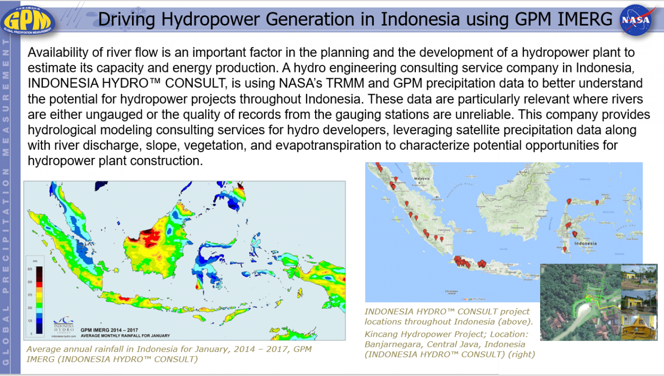
Driving Hydropower Generation in Indonesia using GPM IMERG Thursday, June 14, 2018 Download Highlight GPMHighlight6_14_2018IndonesiaHydropower.pptx1.79 MB
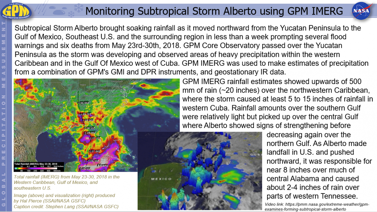
Monitoring Subtropical Storm Alberto using GPM IMERG Thursday, June 14, 2018 Download Highlight GPMHighlight6_14_2018SubtropicalStormAlberto.pptx1.91 MB
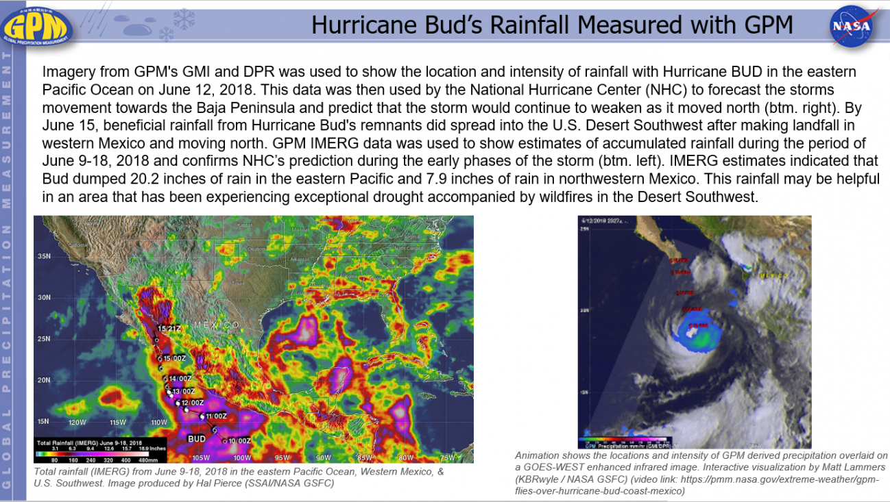
Hurricane Bud’s Rainfall Measured with GPM Thursday, June 21, 2018 Download Highlight GPMHighlights6_21_2018HurricaneBud1.pptx2.04 MB