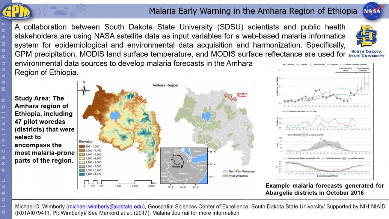
Malaria Early Warning in the Amhara Region of Ethiopia Thursday, June 7, 2018 Download Highlight GPMHighlight6_7_2018SDSU.pptx620.98 KB
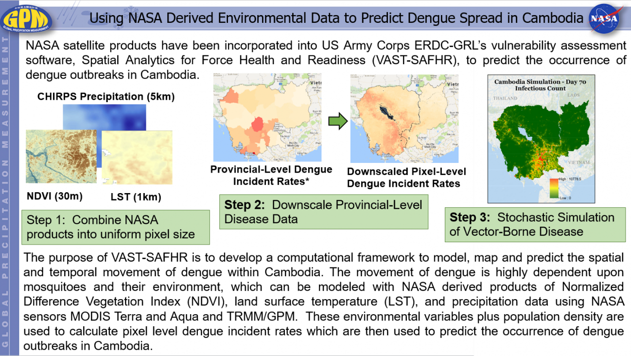
Using NASA Derived Environmental Data to Predict Dengue Spread in Cambodia Thursday, June 7, 2018 Download Highlight GPMHighlight6_7_2018USArmyCorps.pptx1.02 MB
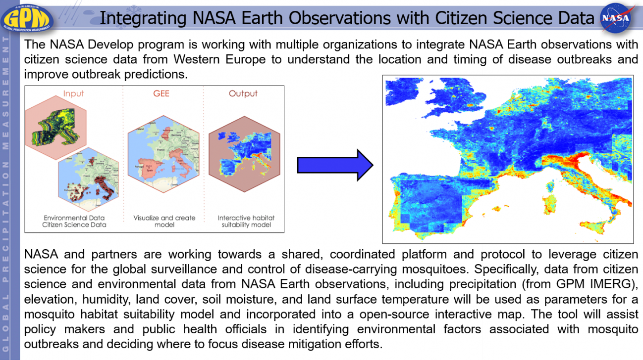
Integrating NASA Earth Observations with Citizen Science Data Thursday, June 7, 2018 Download Highlight GPMHighlight6_7_2018Develop.pptx1.02 MB
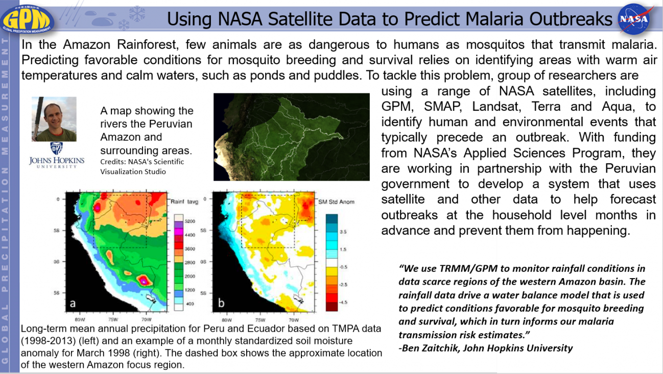
Using NASA Satellite Data to Predict Malaria Outbreaks Thursday, June 7, 2018 Download Highlight GPMHighlight6_7_2018HealthBZ.pptx942.52 KB
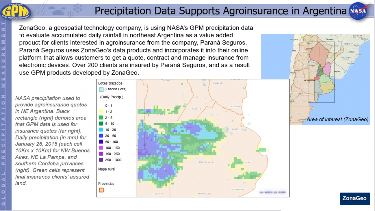
Precipitation Data Supports Agroinsurance in Argentina Thursday, June 7, 2018 Download Highlight GPMHighlight6_7_2018ZonaGeo.pptx551.9 KB