Document Description

The GPM Combined Radar-Radiometer Algorithm performs two basic functions: first, it provides, in principle, the most accurate, high resolution estimates of surface rainfall rate and precipitation vertical precipitation distributions that can be achieved from a spaceborne platform, and it is therefore valuable for applications where information regarding instantaneous storm structure are vital.

Date Last Updated
December 17th, 2021
Document Description

This document describes the basic idea of DPR data processing. It was originally written for the algorithm used in the at-launch version (V03). The algorithm has been modified and improved since then. Although the basic idea of data processing remains the same, the actual flow of processing, in particular that in the solver module, has changed substantially. As a result, some part of description in Section 3.1 may not be relevant any more.

File Downloads

Tropical Storm BEATRIZ Forms Off Mexican Coast

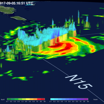
Tropical depression 02E was upgraded to tropical storm Beatriz on 19 June 2011 at 1800 UTC (1100 AM PDT). The TRMM satellite flew over on the same date at 1105 UTC( 0400 AM PDT) obtaining data used in the image shown above. Beatriz was already well organized with TRMM's Microwave Imager (TMI) and Precipitation Radar (PR) data showing that thunderstorms were dropping heavy rainfall in a large area near the center of the forming storm. PR data revealed that some of these powerful storms were reaching heights above 15 km (9.3 miles).

Another Tropical Cyclone Develops Near The Philippines

The sixth western Pacific tropical cyclone (06W) of 2011 has developed near the Philippines. Tropical storm AERE, super syphoon SONGDA and Tropical Storm SARIKA have already affected the Philippines this year. The TRMM satellite had an early morning look at the forming depression on 16 June 2011 at 2130 UTC. A precipitation analysis from TRMM's Microwave Imager (TMI) and Precipitation Radar (PR) shows that 06W wasn't well organized but contained areas of moderate to heavy rainfall located east of the Philippines. 06W is expected to intensify to a tropical storm, brush the northeastern coast of

TRMM Sees Adrian's Eye

Hurricane Adrian's eye was clearly seen by the TRMM satellite when it passed over on 10 June 2011 at 1608 UTC. The heavy rainfall completely surrounding Adrian's well defined eye was revealed with TRMM Microwave Imager (TMI) data obtained at the same time. Hurricane Adrain, located southwest Mexico , was classified as a dangerous category 4 on the Saffir-Simpson scale with sustained wind speeds estimated at 115 kts (~132 mph).